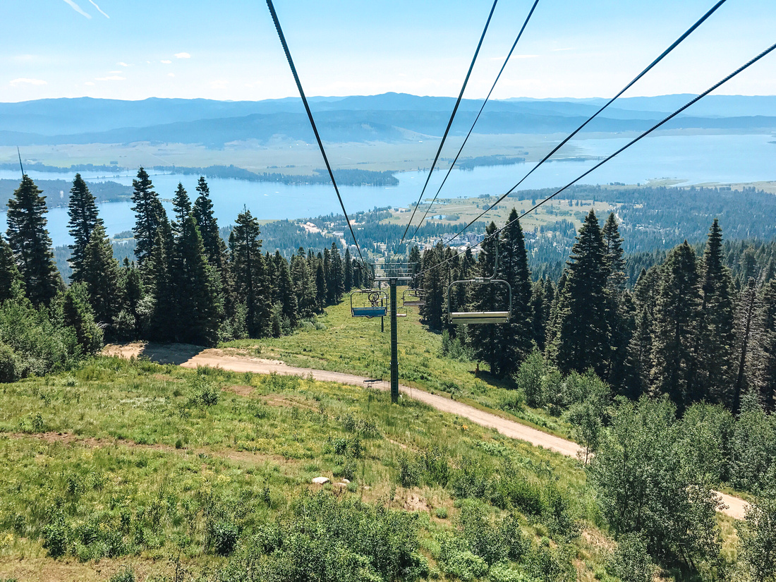
Our Recommended Route: Grandjean to Baron Lakes, Alpine & Redfish Lake
Explore the best Baron Lakes Idaho hikes with our backpacking guide. Our favorite 24-30 mile route begins at the Grandjean Campground Trailhead before winding up along Baron Creek to the three Baron Lakes. Camp along a dramatic ridge or push through to the lakes for your first night. And enjoy unobstructed views of the stars from these 8,000 foot alpine lakes. Make your way up and over the more than 9,000 foot saddle before descending to Alpine Lake for another epic night under the stars. Hike the last 7 miles to the Redfish Lake ferry dock, or continue around the ridge trail to the Redfish Lake Lodge for a few extra miles of elevated views. Keep reading for all the information you’ll need to plan and execute your best Baron Lakes Idaho hikes. Click here to get right to our route maps and route guide.
Upper Baron Lake, just below the saddle leading to Alpine and Redfish Lakes
When hiking the best Baron Lakes Idaho hikes, you’ll be entirely within the Sawtooth National Recreation Area. This remarkable federal reserve spans more than 750,000 acres and three wilderness areas. The Sawtooth Wilderness, Cecil D. Andrus-White Clouds Wilderness, and the Hemingway-Boulders Wilderness areas all make up the Sawtooths. And with more than 700 miles of developed trails and 300+ alpine lakes to explore, you’ll find endless areas to discover within the National Recreation Area.
Looking down past moss and trees to middle Baron Lake
Maps of the Sawtooth National Recreation Area
The U.S. Department of Agriculture Forest Service provides a variety of Sawtooth National Recreation Area maps. The map below shows the original Sawtooth Wilderness (~217,000 acres), established in 1972. It also shows the more recent additions to the National Recreation Area, most recently expanded to 756,000 acres in 2015. Keep reading for Google maps with directions to Grandjean and Redfish Lake, as well as our route maps for the best Baron Lakes Idaho hikes.
The ridge above the Baron Lakes, Sawtooth Wilderness
Planning to explore the best Baron Lakes Idaho hikes soon? Use our links to get discounted car rentals from Boise, essential Camelbak gear, and more! Our site is partly supported by affiliate partnerships; your purchases through our affiliate links help support our site and the development of even more great content.
Directions to the Sawtooth Wilderness Grandjean Trailhead
Because the Sawtooth National Recreation Area is so large, there are various points of access. You can get to the Sawtooths from Sun Valley and Galena Summit to the southeast, Missoula and Salmon to the north, or Boise to the southwest. To simplify directions, we’ve provided the two main routes to access Grandjean and the Grandjean Campground and Trailhead. One approaches from Boise, and the other comes through Stanley. Whether you drive from Missoula and Salmon to the north or Sun Valley to the southeast, you’ll pass through Stanley and head over Banner Summit before dropping down to the 7-mile gravel road to the Grandjean Trailhead.
The Grandjean Trailhead at the Grandjean Campground
Directions from Boise through Lowman
Boise to the Grandjean Trailhead: 103 miles (166 km)
Distance from Boise to Banks, Idaho: 42 miles (68 km)
Banks to Lowman, Idaho: 33 miles (53 km)
Lowman to National Forest Road 524: 21 miles (34 km)
NF Road 524 to Trailhead: 7 miles (11 km)
Driving from Missoula or Sun Valley through Stanley
Stanley, Idaho to the Grandjean Trailhead: 44 miles (71 km)
Distance from Stanley, Idaho to National Forest Road 524: 37 miles (60 km)
NF Road 524 to Trailhead: 7 miles (11 km)
Explore the Best Baron Lake Idaho Hikes from Grandjean to Redfish Lake.
The Grandjean Trailhead to Middle Baron Lake – 13.34 miles
Trail Maps and Route
For the best Baron Lakes Idaho hikes, we chose a 25 mile route from the Grandjean Trailhead to Baron Lakes, Alpine Lake, and then out via Redfish Lake. Although we ended at the Redfish Lake Inlet Campground and rode the ferry across the lake, you can continue to hike the 7 or so miles along the ridge for a longer hike.
We hiked the most our first day, with a total of 13.34 miles to stay the first night at Middle Baron Lake. (We wanted to get night shots of the Milky Way at the alpine lakes both nights, or else we would have camped on a high ledge overlooking the Baron Creek drainage). Day two, then, only left us with about 4 miles up and over the saddle to Alpine Lake. And our final day out to Redfish required the final 7.23 miles. Keep scrolling or click on any of the links below to jump to a section of the trail.
Leaving the Grandjean Trailhead Toward Baron Lakes
The trail leaving the Grandjean Trailhead forks almost immediately, leading north to follow the wilderness boundary toward Stanley Lake or east along Baron Creek. Here, you’ll want to follow the creek upstream along the gradually sloping valley. A second fork around mile 3.5 similarly leads north toward Sawtooth and Stanley Lakes or further southeast. At both forks, continue east/southeast along Baron Creek.
Wildflowers grow along Baron Creek
Trail markers clearly indicate trails at trail forks
The first several miles roll by quickly, because the trail gradually climbs through a long valley along Baron Creek. Although you’re gaining altitude slowly and steadily, this feels like a pretty easy hike. And there are plenty of spots to stop and filter water along the creek. The scenery along these first four miles alternates between dense, forested groves to open, sprawling meadows. Some sections display remnants of wildfire burns. And more recent landslides, caused by a major earthquake and aftershocks in 2020, can be seen along the creek.
Burned trees provide wildlife habitat and varied scenery along Baron Creek
Crossing the North Fork of Baron Creek
At the 3.5 mile mark, you’ll approach the convergence of the North and Main Forks of Baron Creek. A fairly sturdy log crossing takes you across the North Fork just before it joins the main Baron Creek. Various paths lead to the water’s edge, making this a great spot to refill water bottles and refresh before the climb further up the valley. Just beyond the creek crossing, you’ll come to the second fork in the path. Heading north (to the left), you’ll quickly ascend along the North Fork of Baron Creek toward Sawtooth Lake and incredible, sweeping views of Williams, Thompson, and other northern peaks. Keep heading southeast along the main fork to more gradually ascend toward Baron Lakes.
After the water crossing, you’ll notice that the views of the jagged Sawtooths really begin to appear. You can see a number of peaks along the entire route, but here they start to increase in size and frequency. As you approach 4 miles, you’ll continue to pass through shady Aspen groves and stands of pine trees between open meadows. Watch for car-sized boulders that recently shook loose in the earthquake and aftershocks. You can distinguish these clean, freshly-fallen rocks from mossy, embedded boulders that have been on the valley floor for much longer.
About one mile past the North Fork Crossing, you’ll come to a smaller crossing at Moolack Creek. Once you cross Moolack, you’ll start to see even more evidence of the powerful earthquake and aftershocks that sent massive boulders tumbling. The mass and momentum of these huge stones snapped trees in their path and gouged small ravines as they tumbled down steep mountainsides. Forest Service trail teams have cleared the trail in sections that were buried beneath the falling rubble. But you can still see the incredible, powerful effects of the earthquake and dozens of aftershocks that rocked the area for months.
Between miles 8 and 9, you’ll enter a stretch of tall forested groves on either side of the creek. This offers some shade before the next section of trail (below), where you’ll climb switchbacks through exposed shale fields. Here, though, you can enjoy semi-covered vantage points for viewing the rugged peaks across the creek. Pima Peak and the back of Warbonnet Peak can be seen here, and waterfalls cascade from higher elevation lakes.
The view toward Grandjean from the Baron Creek Overlook, mile 11
Hiking to Exposed Switchbacks from Baron Creek
As you wind through the dense forested area near Baron Creek, the path will begin to switch back away from the creek. There are several turns still in the tree stands, and the elevation gain will begin to steadily increase. If you didn’t refill your water bottles below, you’ll have the chance to refill in just a mile, near the top of the Baron Creek Falls. For now, though, the trail diverges from the creek to begin the steep climb to the overlook.
Along the trail to the Baron Creek Falls Overlook
Jagged peaks above the switchbacks up to the top of Baron Creek Falls
You will quickly leave the protected tree stands and follow the trail through exposed shale fields at the base of jagged peaks. The trail is well made and maintained, but the difficulty here is the steeper pitch and fully exposed path. The reflection of sun from the shale makes this stretch even hotter and drier than lower elevations. But the switchbacks to the overlook last only about a mile. And then you’ll have one of the longest panoramic views of the entire route, looking back down Baron Creek toward Grandjean. At a little over 11 miles to this point, you’ll find a number of dispersed campsites near the overlook. This is a great spot to set up camp if you’re not pushing to get to the lakes, or if you’re maxed out on mileage for your first day.
In this section of the hike, you’ll find more leveled sections of trail alternative with small switchbacks and gradual climbs to Little Baron and Baron Lakes. Just beyond the overlook and falls, there are trails to dispersed camp sites and creek access. A little further down the trail, the path levels out into wildflower meadows and 360-degree views of the surrounding peaks, now just over 1,000 feet above the trail. After 11 miles and a steep section of switchbacks, this feels very relaxed and easy-going by comparison.
After crossing a broad meadow, you’ll approach a sturdy bridge that crosses a wide section of Baron Creek. Once you cross the bridge, you’ll have several miles of cool, forested trail. The trail continues to follow the creek, first past Little Baron Lake from a distance. It then winds around various rock outcroppings before eventually arriving at the Baron Lake outlet. This section of the Baron Creek Trail offers some of the most lush, green scenery of the entire route. The cooler, high elevation temperatures and cascading creek create a beautiful landscape of dense, green foliage. You almost won’t notice the increased number of mosquitos breeding and feeding along the water.
First look at Baron Lake, as the trail reaches the outlet to the lake.
The Approach to Baron Lake
First Look at Baron Lake
The Baron Lakes consist of three separate alpine lakes, Upper Baron, Baron Lake, and Little Baron Lake. Starting with the highest elevation lake, Upper Baron, the lakes feed one another and then drain into the valley below beyond Baron Creek Falls. Coming from Grandjean, the Baron Creek Trail bypasses Little Baron, but it’s easy to explore the lowest elevation lake using any number of spur trails as you make your way toward the largest of the three, Baron Lake. The lake suddenly emerges as the trail follows the outlet stream from below. After several miles of winding, climbing trail, you’ll find yourself just below the lake’s edge, where logjams narrow the lake to a small outlet stream. Within a few steps, you’ll transition from thick, forested hillsides to spacious Baron Lake, surrounded by towering, jagged peaks.
If you push through to Baron Lake on your first day, you’ll climb nearly 4,000 feet over almost 13.5 miles. Arriving before dusk, you’ll enjoy some of the best changing, shifting light the lake has to offer. As the sun sets to the West, shadows climb the Eastern wall of jagged mountain peaks. Light streams through vertical openings in granite cliffs, casting irregular patterns of shadow and light across the lake throughout the evening. Choppy afternoon waters reflect sunlight off the water until the light gives way to shadows and myriad logs, boulders, and rainbow trout can be seen beneath the water’s surface.
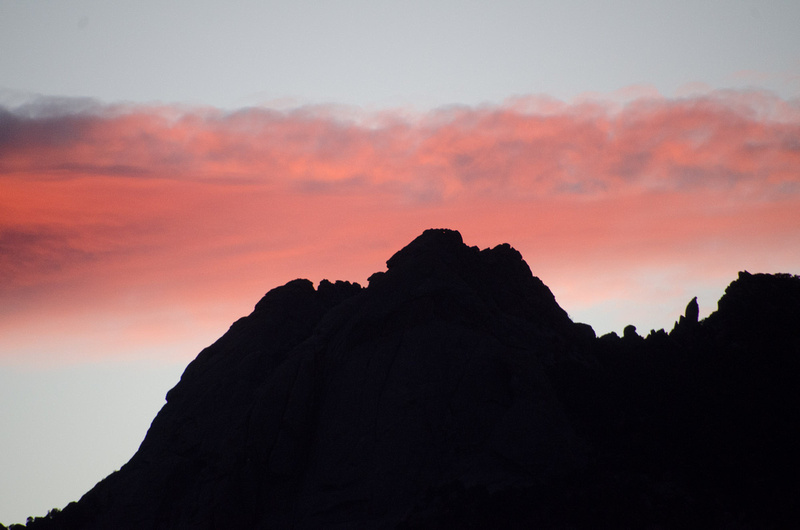
Baron Lake at dusk
Fishing, Floating, and More at Baron Lake
Baron Lake is well-stocked with native Idaho trout, and it’s a great lake to float if you’re willing to bring a lightweight, packable tube or board. The cold alpine water offers a refreshing dip after a long hike, and scenic views change with each few steps around the lake. From high-traffic camping and fishing areas to more remote, secluded spots, Baron Lake has whatever type of backpacking experience you’re looking for. Stay a few nights and camp to the remote western shore. Enjoy the larger, dispersed group areas to the north. Wade past the numerous fallen logs and enjoy a swim or cast your line, with or without waders. Baron Lake is more than 10 miles from the nearest access point, so even during peak season, you’ll find plenty of space to relax, unwind, and get away from it all.
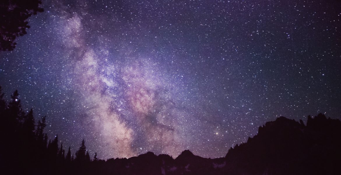
We planned to spend two nights at lakes along our route, specifically so we could capture images of the Milky Way over Baron and Alpine Lakes. For clear, summer night skies, you can’t beat the seclusion and darkness of the Sawtooth National Recreation Area. We planned our trip during new moon, so we had even less ambient light to deal with. From the main north shore campground at Baron Lake, you’ll see clear, open skies like these, with wide angle views of the Milky Way to the south.
Camping spots at Baron Lake’s north shore, looking south toward Upper Baron Lake
Sunset around Baron Lake
Campsites at Baron and Upper Baron Lakes
Some of our favorite camp sites are actually in between Upper and Baron Lakes, with views of both. But if you’re coming from Grandjean in a single day, that can be nearly 15 miles plus time scrambling around the hillside looking for a flat enough spot to camp. So for ease and simplicity, any of the most popular camping areas at the outlet on Baron Lake’s north shore offer the most convenient and accessible sites. There are enough sites for small groups in the shelter between rock outcroppings, or slightly elevated areas large enough for a few single tents or bivy sacks.
Morning view from camping spots at Baron Lake’s north shore
From Baron Lake’s north shore, the trail crosses the inlet and then circles around the east side of the lake. Gradual switchbacks wind through the surrounding forests before approaching the third and final Baron Lake. From Baron Lake (below) to Upper Baron Lake (above), the views change rapidly, along with the shade and color of the lakes. Glassy, reflective surfaces give way to deep, turquoise blue-green water. Boulders, large and small, line the bottom, under a layer of fallen trees, all perfectly visible beneath the crystal clear alpine water.
Last look at Baron Lake
Views of Upper Baron Lake
Baron Lake has some of the most sweeping views and dramatic cliff formations in the Baron Lakes Basin. But Upper Baron Lake may be the most picturesque. The bright green and turquoise water of the lake, combined with bright sun reflecting off bleached white boulders make this spot bright, colorful, and awe-inspiring. The light and proximity to the surrounding peaks (less than 1,000 feet away) make Upper Baron feel like it’s floating above the rest of the Sawtooths. Depending on how may days and nights you’ve planned, you may want to spend some extra time at Upper Baron. It’s a unique alpine spot, unlike any other place along the entire route.
Ascending from Upper Baron Lake to the saddle that leads over and down to Alpine Lake, you’ll have a clear view of Warbonnet Peak and others. The tallest pinnacle in these photos, Baron Spire, known to climbers as “Old Smoothie” toppled and fell from an earthquake aftershock less than one week after we took these photos. Even though the landscape has changed dramatically, though, it’s no less awe-inspiring. As you ascend from Upper Baron, you’ll climb another scree field laced with switchbacks. Unlike the ascent to Baron Creek Falls, though, here you’ll find numerous stands of tree stands and the occasional ground spring. As you make your way to the nearly 9,200 foot summit and saddle, you’ll find plenty of spots to stop and enjoy the sweeping panoramic views.
Views of Upper Baron Lake
The Highest Point of the Baron Lakes Idaho Hikes Route
Once you leave Upper Baron Lake toward Alpine and Redfish Lakes, you’ll have about one mile and nearly 1,000 feet of elevation gain to the summit. After a final push to the top, you’ll have 360-degree views from the heart of the Sawtooth Wilderness. You’ll see over the peaks surrounding the Baron Lakes Basin and south past Alpine Lake toward the Alice/Toxaway Drainages and beyond.
Baron and Upper Baron Lakes from the saddle toward Alpine and Redfish Lakes
After the push to Baron Lake and the steep ascent to the saddle, the descent to Alpine Lake feels pretty nice. Except for the fact that it’s easier to twist an ankle or otherwise injure yourself with a dramatic shift in incline when fatigued, this downhill slope is a welcomed change of pace. The first mile mirrors the other side of the saddle. Switchbacks wind back and forth along the bouldered trail, past a murky pool toward several larger (and prettier) lakes below. If you’re hoping to avoid the more popular camp sites at Alpine Lake, this area offers some great dispersed camping with access to water and a lot more seclusion.
A hiker ascends the saddle toward Baron Lakes
Scenery along the trail to Alpine Lake
Approaching Alpine Lake
The trail descends sharply at the outlet to the lake above Alpine, but then levels out into a series of gradual switchbacks through forested hills. The Alpine Lake Basin comes into view as you wind your way down. It’s easy to keep hiking past the spur trails that lead to camping areas along the lake, so keep your eyes open for paths toward the lake.
As with Baron Lake, Alpine has several popular, high-traffic camping areas on the north shore. A short hike to the southwest leads around the lake to additional dispersed camping spots, as well as a large boulder complex that overlooks the lake. Even though you can usually find plenty of spots along the southwest side of the lake, the path is well-worn and easy to find. Get here early, and you can snag the prime spot on top of the boulders. Get here later, and there are some great sheltered areas near the inlet stream and further around to the south.
Views of the southwest side of Alpine Lake
Views of the trail to the southwest side of Alpine Lake
Views of the peaks around Alpine Lake, Sawtooth Wilderness
Alpine Lake Views
Alpine Lake is a popular destination because it’s only about 7 miles from the Inlet Campground at Redfish Lake. It’s far enough out to dissuade day hikers, most of whom venture into the drainage below but not up to the higher elevation lake. But after a short time at Alpine Lake, you’ll see why it’s a favorite overnight destination and a great way to easily explore the Sawtooth Wilderness. Day or night, the views around Alpine Lake can be spectacular. From wide-open views of the Milky Way to colorful palettes of blue and green, Alpine Lake is a beautiful destination, whether you plan a through hike or just a quick round-trip.
Views of the peaks around Alpine Lake, Sawtooth Wilderness
A short distance past Alpine Lake lies a massive granite shelf overlooking the glacier-carved valley below. A unique feature of this overlook and granite slabs lining the trail down to Redfish lake are deep etchings carved by the glacier that once carved this sweeping valley. The marks are most obvious on the overlook, due to the location and size of the granite. But smaller slabs throughout the valley show the telltale signs of glacial carving. We happened upon a songbird in the early morning as we approached the overlook. This is the last panoramic viewpoint before you begin the fairly rapid descent to the valley below.
Etched granite overlooking the glacial valley below
The trail from Alpine Lake to Redfish, looking back up toward Alpine Lake
Changing Geology, Flora, & Fauna
After admiring the dramatic drops from the granite overlook, you’ll follow the trail along the ridge before dropping down into the valley for several final miles along the creek that empties into Redfish Lake. And even though you’re dropping in altitude, the views continue to impress. There are the jagged cliffs that line the entire draw. And numerous spots where giant boulders – old and new – have tumbled down to their new resting places. Fresh fallen boulders from earthquake activity have snapped trees and left a trail of debris in their wake. More established boulders have created animal shelters and unique formations for forest undergrowth. This section of the route provides a variety of geological and ecological sights unlike those on the Baron Creek side of the mountains.
The descent from the granite overlook winds down through the valley for another 6 miles before the trail approaches Redfish Lake. Just before the final descent to the ferry dock and campground, you’ll pass a fork in the trail. Here, if you want to climb back up the western ridge, you can continue hiking to the Redfish Lake Lodge. We’ve hiked this stretch a number of times, including the turn further up that leads to the Cramer Lakes area. The hike around the lake follows the high ridge above the lake, so water access is limited. But the views are broad and interesting as you wind around Redfish.
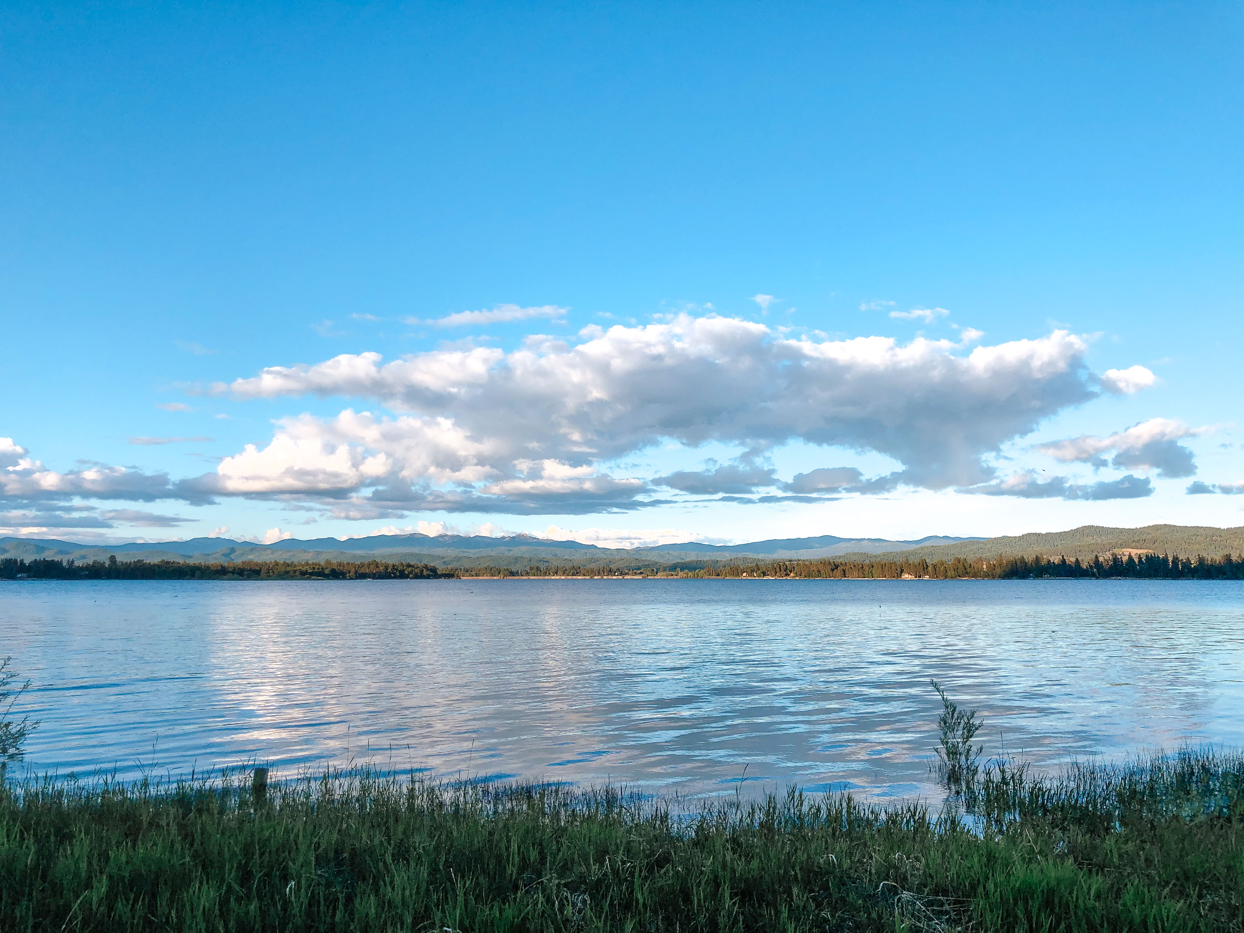
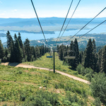
Redfish Lake Inlet Campground and Redfish Lake Lodge
If you don’t continue around the lake on the ridge trail, you can catch a ride on the ferry back to the Redfish Lake Lodge. The ferry maintains a regular schedule during summer (usually 9, 12, 2, and 4 pm), or on demand from the Lodge. If you arrive between the regularly-scheduled arrival times, you may still be able to catch a ride if an unscheduled party is dropped off. Regardless, when you arrive back at the Lodge docks, you’ll have to pay the one-way fare (around $12 per person).