Idaho National Parks – City of Rocks National Reserve
#PNW . Hiking . Idaho . Outdoor Recreation . TravelContents of this Post
Explore the Best National Parks in Idaho
The City of Rocks National Reserve and Castle Rocks State Park
Hike, climb, bike, and camp your way through Idaho National Parks, starting with the City of Rocks National Reserve and Castle Rocks State Park. From world-class rock climbing to rugged hiking trails and abundant wildlife, this national reserve has something for everyone. The City of Rocks sits just South of the Snake River Plain in Southern Idaho, a short drive from Boise and Salt Lake City.
What to do at The City of Rocks National Reserve – Our Recommendations
Keep reading for information on camping, hiking, trails, amenities, and other critical things you’ll need to plan your visit. We’ve highlighted our favorite places to explore, and access points for all of the reserve’s best outdoor recreation. Use the Table of Contents above to search our post, or keep scrolling for recommendations and images to inspire your next trip to Idaho National Parks and the City of Rocks National Reserve!
Information About the City of Rocks National Reserve
Fees & Amenities
Day Use Fees & Passes
- Motor Vehicle Entry Fee: Free! There is no day-use fee to enter the reserve.
- Even though this Federal Reserve is free to visit, check out the National Park Service website for information about annual passes and benefits of a National Park Pass, including:
- $80 Standard Annual Passes.
- Free Annual Passes for U.S. Military Members and Dependents.
- Free 4th Grade Annual Passes.
- $20 Annual Senior Passes.
- $80 Lifetime Senior Passes.
- Free Disability Access Passes.
- Free Volunteer Passes.

National Reserve Camp Site and Reservation Information and Fees
| Campsites | $12.72 per night |
| Group Campsites | $26.50 + $3.18 per night, per person (12 minimum) |
| Reservation Fee | $10.60 per reservation |
- The City of Rocks National Reserve and Castle Rocks State Park are jointly managed by the National Park Service, the U.S. Department of the Interior, and the Idaho Department of Parks and Recreation. Idaho State Parks manages the camp sites and reservations, which means you can reserve up to 9 months in advance, unlike the normal 6 month federal window for federal campgrounds and camp sites.
- 63 camp sites and 2 group sites can be reserved online through the Idaho State Parks Reserve America website or by calling 1-888-922-6743
- Click here to view maps of the camp sites and camping areas.
- Sites are spread throughout the National Reserve in 7 designated camping areas.
- Many sites are next to climbing rock and other natural features, so you can stay right in the heart of the City of Rocks.
- Call the reservation center 7 days a week: 8:00 am – 7:00 pm Monday through Friday or 9:00 am to 5:00 pm Saturday and Sunday

National Reserve Camp Site Rules and Regulations
- Camp sites range from smaller, 14-foot gravel pads to 100-foot group sites.Pack-it-in/Pack-it-out rules apply to campsites 61-64, and the Juniper and Twin Sisters group site.
- Campfires are allowed in designated areas only, but gathering wood for campfires is prohibited.
- Firewood is available for purchase in nearby Almo, or from the City of Rocks Retreat.
- Fireworks are prohibited in all parks at all times.
- Quiet hours are enforced from 10:00 pm to 7:00 am.

“Planning Your Visit. City of Rocks National Reserve offers scenic walks near the California Trail, photography, world-class technical rock climbing, hiking, birding, mountain biking, horseback riding, picnicking, and camping.”
– National Park Service Visitor’s Guide to the City of Rocks National Reserve

Booking Camping Sites in Advance – Recommended Timeline
- Plan ahead: federal and state campgrounds fill up FAST. Figure out when you plan to travel and then set a calendar reminder 9 months ahead (for Idaho State Parks through Idaho’s Site on ReserveAmerica.com).
- If you don’t get a site in one of the state or federal campgrounds, call the specific campground or look online to see if they have walk-up sites available.
- If no sites are available online or as walk-up sites, look on Reserve America for nearby private campgrounds and RV Parks, like the City of Rocks Retreat, which offers a variety of accommodation options very close to the Castle Rocks State Park Campground.
National Reserve Hours and Visitor Center Information
- The City of Rocks National Reserve is open year-round, 24/7. Some roadways and trails may be inaccessible due to weather conditions, but the City of Rocks never closes.
- The State and Federal Visitor Center, located in Almo, is also open year-round, with seasonal hours in the winter.
- Operating hours: 8:00 am to 4:30 pm.
- Open 7 days a week, including holidays during peak season.
- Closed holidays during the off season.
- National Park Center Contact Information:
- City of Rocks National Reserve, P.O. Box 169, Almo, ID 83312
- Telephone: 208-824-5901
Planning a trip to Idaho National Parks, the City of Rocks National Reserve, or Castle Rocks State Park soon? Use our links to get discounted flights, RV rentals, and more! Our site is partly supported by affiliate partnerships; your purchases through our affiliate links help support our site and the development of even more great content!
Getting to the City of Rocks National Reserve
Driving from Boise
- Boise to City of Rocks: 204 miles (328 km).
- Twin Falls to City of Rocks: 283 miles (134 km).
- Burley to City of Rocks: 45 miles (72 km).
Driving from Salt Lake City
- Salt Lake City to City of Rocks: 163 miles (262 km).
- Distance via I-80W through Kelton: 194 miles (312 km).
Outdoor Recreation at Idaho National Parks
Rock Climbing at the City of Rocks National Monument – Idaho National Parks
World-Class Rock Climbing
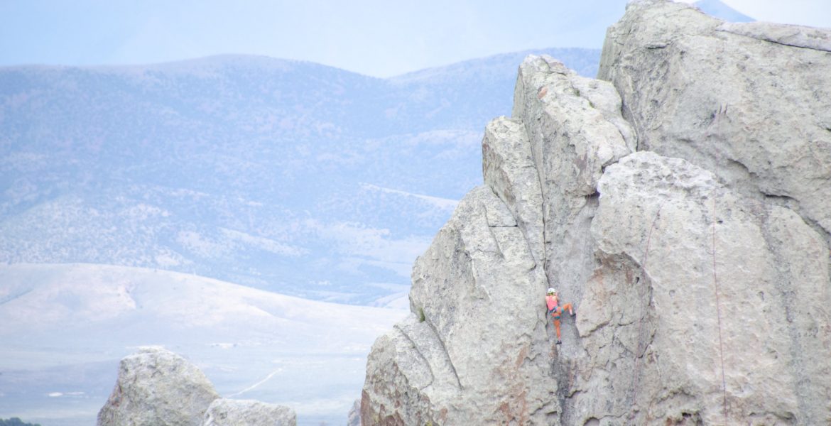
City of Rocks offers some of the best rock climbing in the West. This unique combination of moderate to advanced climbs require a range of technique and style to climb both single and multi-pitch routes in the Reserve. And many of these single and multi-pitch routes sit side-by-side, from moderate (5.6-5.9) to advanced (5.10-5.13) climbs. In all, the Reserve has about 700 developed routes, from Twin Sisters in the South to Bread Loaves in the Northwest. And there are hundreds of climbing spots in-between.
Rock Climbing Information, Closures, Updates, and Restrictions
- Up-to-date information is posted at the Bath Rock kiosk, visitor center, and online at the National Park website.
- Closures throughout the spring and early summer often relate to nesting Red Wing Falcons and other raptors. The website, visitor center, and kiosk have all the latest updates and closures.
- Summer weather can rapidly shift, including afternoon thundershowers and temperature fluctuations from the 90s down to the 30s at night. For current weather conditions, check out the National Park Service Facebook page.
- Registration and permits are not required to climb, unless you plan to place permanent anchors. (Check out the “Climbing Management Plan” PDF for Castle Rocks below for the permit forms you’ll need, pages 15-17). Otherwise, you can climb established routes without a permit.
- Climbing is not allowed in the historical California Trail corridor that runs from the Almo entrance to the East of the Reserve and cuts past Camp Rock and Register Rock down past Twin Sisters to the Southwest. Most of the geological formations are to the North and West of the Trail, so there are plenty of other places to climb.

Summer Climbing Demonstrations
Park staff provide a range of climbing programs in the summer season, from climbing demonstrations to the Climbing Experience Program. If you are new to climbing, this is a great way to learn about climbing, gear, pitch, and how to climb safely within your skill level. Equipment is provided, and you can sign up for the program on Friday, Saturday or Sunday for $30 per person, ages 10 and up. Groups are capped at 4. For updates, program information, and closures related to COVID-19, visit the National Park website’s climbing page.
Hiking at the City of Rocks National Monument – Idaho National Parks
City of Rocks Hiking Information
Inside the City of Rocks complex, 22 miles of hiking trails wind around dramatic geological formations to climbing areas and scenic overlooks. The lush aspen groves and shady trails throughout the Reserve may surprise you, given the arid, high desert climate of the region. Trails range from an easy loop around some of the climbing rocks to a 6.3 mile loop at the heart of the Reserve. We’ve put together our three favorite hikes for relatively easy sightseeing in the Reserve. Two of these provide easy access to scenic views and climbing areas, while the third offers a slightly longer hike through shady aspen groves to the Tea Kettle formation.
City of Rocks Hikes: Tea Kettle Trail
Tea Kettle Trailhead and Parking
The Tea Kettle Trail begins at the Bread Loaves camp site parking lot, at the base of the Bread Loaves formation. Vault toilets sit opposite the camp, and camp sites stretch along a section of the rock formations, so there are plenty of spots to camp, climb, and hike from.
Tea Kettle Trailhead Additional Parking
If you park on the main City of Rocks road, there is a pull-out parking area at the end of an overgrown access road leading straight up to Bread Loaves. This adds about .25 miles to the total hike. The distance from the trailhead to the Tea Kettle formation is less than a mile, and it’s an easy hike the entire way.
Tea Kettle Trail Difficulty
The Tea Kettle Trail is easy, mostly level and flat, and accessible to all skill levels. Though the trail is not paved and wide enough for accessibility for wheelchairs, it is well maintained and level. Lush green grasses and mountain quaking aspen groves line the route, making for a pleasant, cool hike on a hot summer day.

City of Rocks Hikes: Window Arch
Window Arch Access and Parking
Window Arch sits just 300 feet from nearby camp sites and parking a few hundred feet from the main City of Rocks Road through the Reserve. Steep terrain around Window Arch make it a little more challenging to access this natural feature. But access from the back of the Arch to the East makes it easier to approach.
Hiking Around Window Arch
Once you get down to Window Arch, there are plenty of boulders and other formations to explore all around the Arch. The surrounding rock provides plenty of grip and traction for bouldering and exploring. The complex sits at the top of steep cliffs, so be careful whenever near the ledge, because the drop off in places can be higher than 100 feet.
Bouldering at Window Arch
Hiking trails lead down into the canyon and around the areas surrounding Window Arch. But if you want to do some easy bouldering, this is a great area for that. There are lots of interesting natural features and rock formations to explore right around Window Arch. All the standard recommendations apply: leave no trace, pack-it-in/pack-it-out, and don’t damage the formations and surrounding landscapes.
City of Rocks Hikes: Elephant Rock Loop
Access and Parking for the Elephant Rock Hiking Loop
The trail that loops around Elephant Rock connects with climbing access trails leading from the Elephant Rock designated parking areas. The trail connects the climbing access trails with a circular trail system on the back side of the formation. From the parking area, take the main trail and then hike either way around the rock formation for an easy, 30-minute hike.
Elephant Rock Loop Difficulty
The front half of Elephant Rock is easy to access, and the trails leading to the climbing routes are well-worn. Once you get halfway around the formation, though, the trail thins out and is less maintained. On the back side of the trail, dense high-desert vegetation has grown over much of the trail. The trail ascends steeply in parts here, too. Overall, the short loop around Elephant Rock is an easy hike, with just a few steep sections.
History at City of Rocks National Reserve – Idaho National Parks
Indigenous History
Early Diplomacy and Chief Pocatello
“At City of Rocks in 1858, the first diplomacy between Gammudeka’a, Tevadeka’a, and Hukandeka’a leadership and the United States occurred. Pocatello met with Frederick W. Lander, then the Chief Engineer of the federal wagon road being built from the South Pass to City. With kindness they arranged for safe passage for the roadbuilders and emigrants through City and for 400 miles down the Humbolt River Shoshone lands. A year later, at the head of Gammu Hunnu (Raft River), Pocatello received goods for the right-of-way, as promised by Lander, acting as Special U.S. Indian Agent. Those same two years, beginning with Chief Washakie and the Eastern Shoshone people at South Pass, Lander arranged similar payments with other daidaikwani along the road, as compensations for the travelers and livestock coming through and destroying the native grasses, staple plants, and wild game. These agreements did not avert future conflicts.”
– National Park and Idaho State Park Interpretive Sign
The 1863 Treaty and Fort Hall Indian Reservation
“By the 1860s, many Shoshone were forced into negotiations with the United States to restore peace following the winter 1863 massacre at Bear River, a devastating loss of newenee lives. In the 1863 Treaty of Box Elder, Pocatello claimed his peoples’ lands all along Gammu Hunnu to the mountains of Piha Kuyu Hunnu (Portneuf River); however, many provisions of the 1863 treaties have not been respected. U.S. colonization challenged but did not overcome the resilience of Shoshone, Bannock, and Paiute peoples. Eventually, Pocatello’s family and many other bands of newenee came to live with the Bannock on the Fort Hall Reservation, and still their descendants return often on these trails home and remain connected to this place.”
– National Park and Idaho State Park Interpretive Sign
California Trail History
California Trail Emigrant Inscriptions
“The rocks are covered as far up as one can reach or climb, with names of emigrants. We left ours with date in a conspicuous place for the boys behind. We saw the names of some of our acquaintances who passed here two years ago.” – Eliza Ann McAuley, August 9, 1852
– National Park and Idaho State Park Interpretive Sign
Axle Grease and Plant Dye Pigment
“Shoshonean tribes and their ancestors used the rocks for communication. By combining minerals, animal fats. and plant dyes, they created pigments that were used to paint pictographs. These were used to tell stories, depict rituals, record visions, and show territory. Emigrants continued this practice by using axle grease to leave their own messages.”
– National Park and Idaho State Park Interpretive Sign
The California Trail
The discovery of gold in California in 1848 led to massive emigration across the U.S. to California. The California Trail had already begun in 1843 by settlers moving West to claim land, but accelerated with the California Gold Rush. More than 200,000 emigrants crossed the California Trail through City of Rocks. (The National Park Service has published some biographical information for emigrants who left inscriptions at Register Rock). Emigrant James F. Wilkins coined the name in 1849, after following the wagon ruts West through Idaho. With the completion of the transcontinental railroad in 1869, most wagon traffic stopped. Stagecoach routes began to connect rural outposts, including a stage station at City of Rocks. Cattle ranchers and homesteaders moved into the area in the 1870s. Some of the original plats are still in use today.
Photography at the City of Rocks National Reserve – Idaho National Parks
The City of Rocks provides ample opportunity for amateur and professional photography, birdwatching, and more. From diverse ecology and wildlife to geological formations and big skies, the Reserve is a photographer’s paradise. Note that if you plan to conduct any commercial photography, you must first contact the Park to request a permit.
Photography and Biodiversity
Wildlife and Plant Species in the City of Rocks
Wildlife abounds in the 14,407-acre National Reserve. More than 750 species of plants and animals have been documented in the City of Rocks. Flora and fauna thrive in this ecological and biogeographical crossroads between regions North and South. Species from the Great Basin to the South rarely migrate North of this area. The National Park Service identifies species like pinyon pine, pinyon jay, and ringtail that do not range further North. Similarly, Colorado columbine from the Rockies does not occur further West. And Western species like Longhorn plectritis, slim larkspur, and western columbine can be found in the Reserve, but not to the East.
Animal Species Found in the City of Rocks
- Mammals include mule deer, mountain cottontail, blacktail jack rabbit, yellow-bellied marmot, golden-mantled and least chipmunks, mountain lion, bobcat, coyote, moose, and elk.
- 142 species of birds have been documented in the Reserve. The Reserve offers some of the best bird-watching opportunities in this part of Idaho.
- Reptiles include Western Whiptail, Western Fence Lizard, Long-nosed Leopard Lizard, Sagebrush Lizard, Northern Desert Horned Lizard, Rubber Boa, Western Rattlesnake, Great Basin Gopher Snake, Striped Whipsnake, and Wandering Garter Snake.
- The only amphibian observed in the Reserve is the Boreal Chorus Frog.
- For more information, including wildlife checklists and reference books, visit the National Park web page on animals in the Reserve.
Plant Species and Habitats Found in the City of Rocks
- Plant habitats in the Reserve include pinyon-juniper woodlands, aspen-riparian communities, sagebrush steppe, mountain mahogany woodlands and high elevation meadows.
- Tom John’s 1995 Vascular Plants of City of Rocks: An Annotated Checklist documents 450 species of plant life in the Reserve and can be purchased at the Visitor Center or online.
- For more information, including wildlife checklists and reference books, visit the National Park web page on plant species in the Reserve.
Photography and Geology

The Geological Significance of City of Rocks
The federal government designated City of Rocks a National Reserve because of its significant geological formations. Known as granite plutons, the geological regions in the Reserve include the ancient Green Creek Complex and the much younger Almo Pluton. The granite rock faces exposed throughout the Reserve extend far below the surface of the earth. Wind, salt, corrosive chemicals, and repeated freezing and thawing of water shapes the above-ground formations. This creates the caverns, etchings, honeycomb shapes, and rounded elements of the massive granite spires.

Geological Time in the City of Rocks
Most of the visible granite spires in the Reserve come from the 28 million-year-old Almo Pluton. This is the younger of the two series of granite formations. The Green Creek Complex within the Reserve includes 2.5 billion-year-old rock, some of the oldest in the entire United States. Erosion and natural elements have sculpted, shaved, and etched the ancient granite into fascinating and beautiful formations today.


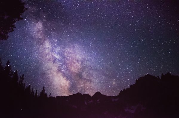

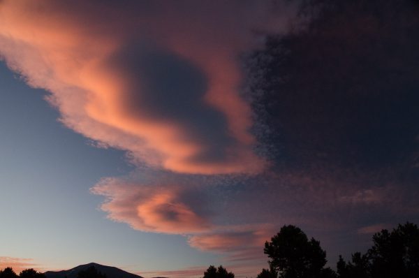
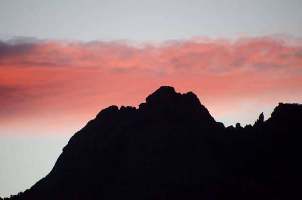



[…] City of Rocks National Reserve […]
This place looks absolutely great.i hope one day I’ll be able to visit.
This place looks so wonderful. I would love to visit here someday.
Thanks for all the info. This place looks so great,I hope I can be here someday. ????
City of Rocks is so beautiful! And it is so affordable. I can see why the camp sites fill up so fast.
I’ve had this on my bucket list for SO long now!!
This is a beautiful post with an awe in it. I haven’t been to the City of Rocks, but would like to venture out.
Oh what a great way to get out in nature and do some exploring. Thank you for sharing your trip with us!
This is an informative post, not only showing the beauty of the national park, but the history in detail. Thanks for sharing, now I know that Idaho has a great and beautiful national park.
Yes I too heard a lot about this place would love to go one day for sure. Adding this place to my bucket list