Idaho Campgrounds – Massacre Rocks State Park and the Oregon Trail
#PNW . Hiking . Idaho . Outdoor Recreation . Trailer Camping . Travel . United States
Contents of this Post
Idaho Campgrounds
Visit the Snake River
Idaho has more wilderness area than any of the other lower 48 U.S. states. Federal and Idaho State campgrounds open up these areas to campers, hikers, and back country wanderers visiting Idaho’s wilderness. Several Idaho State Parks line the Snake river along Idaho’s Southern agricultural belt and Interstate 84. Massacre Rocks sits just East of South-Central Idaho, an easy drive East from Boise and Twin Falls or West or Northwest from Pocatello and Salt Lake City.

What to do at Massacre Rocks State Park
While camping at Massacre Rocks State Park, hike along the Snake River canyon and sections of the Oregon and California Trails. Experience the rich history of the Po’hogwe Trail and learn about the Shoshone people who first inhabited this area of Idaho. Visit nearby attractions in American Falls and fish near the historic American Falls hydroelectric dam, now managed by Idaho Power. Keep reading for our recommendations and tips to make the most of your visit to one of the most interesting Idaho Campgrounds, Massacre Rocks State Park.


Information About Massacre Rocks State Park
Fees & Amenities
Day Use Fees & Passes
- Motor Vehicle Entry Fee: $5 per vehicle.
- Annual Idaho State Parks Pass (in-state): $10.
- Annual Idaho State Parks Pass (out-of-state): $40.
- Visit the Idaho State Parks Website for information about the annual pass and benefits of the unlimited entry passes:
- Unlimited day use access and entry into all Idaho State Parks.
- Boat launch fees included within the State Parks.
- Access to all hiking, cycling, mountain biking, and Nordic ski trials in the State Park system.
- Non-transferable and connected to your vehicle registration.
- Available for purchase from the Idaho DMV.

Serviced Camp Site and Cabin Information and Fees
| Serviced camp site | $24-$29 per night |
| Standard camp site | $12-$21 per night |
| Cabins | $50-$65 per night |
- 42 Serviced camp sites and 4 cabins can be reserved online through the Idaho State Parks Reserve America website or by calling 1-888-922-6743.
- 1 camp site is ADA accessible.
- Limits to Length of Stay: 15 days in a 30-day period.
- Reserve online 24/7.
- Call the reservation center 7 days a week: 8:00 am – 7:00 pm Monday through Friday or 9:00 am to 5:00 pm Saturday and Sunday.
- Check in at 2:00 pm (camp sites) and 3:00 pm (other facilities).
- Check out at 1:00 pm (camp sites) and 12:00 pm (other facilities).

Booking Camping Sites and Cabins – Our Recommendations
Massacre Rocks State Park is one of a handful of state parks along the Snake River as it flows through the Southernmost part of Idaho. (Three Island Crossing and others provide plenty of alternatives if you’re traveling through or want to make a few weekend trips to explore the Snake River basin). And for any Idaho state parks, you can reserve as early as 9 months prior to your stay. We recommend logging in to Idaho State Parks’ Reserve America Site early to get a good spot on your desired dates. Camp site 34 at Massacre Rocks is our favorite. It is not only the closest to the river. It’s also one of the most secluded, and a full-hookup pull-through site.

When and Where to Book Sites and Cabins at Massacre Rocks State Park
- Plan ahead: federal and state campgrounds fill up FAST. Figure out when you plan to travel and then set a calendar reminder either:
- 6 months ahead (for federal campgrounds through Recreation.gov), or
- 9 months ahead (for Idaho State Parks through Idaho’s Site on ReserveAmerica.com).
- If you don’t get a site in one of the state or federal campgrounds, call the specific campground or look online to see if they have walk-up sites available.
- If no sites are available online or as walk-up sites, look on Reserve America for nearby private campgrounds and RV Parks near American Falls.

Camping Amenities and Services at Massacre Rocks State Park
- Showers and bathroom facilities, RV dump station.
- Day-use boat ramps and docks.
- Full disc golf course, hiking trails along the Snake River and Oregon Trail, mountain biking, fishing, and basketball hoops on site.
- Nature store and interpretive center sells disc golf accessories.
- Wifi available on the visitor center deck.
- Shelters and campsites for large groups.
- Abundant high desert wildlife, including:
- Canada Geese
- Grebes
- Bald Eagles
- Pelicans
- Blue Herons
- Coyote
- Muskrat
- Beaver
- Cottontail and Jack Rabbit

Explore Idaho Campgrounds at Massacre Rocks State Park
The Best of Outdoor Idaho
Massacre Rocks State Park itself, besides numerous campsites overlooking the river, has riverside trails that snake around massive boulders and lead up to the tops of cliffs with sweeping, panoramic views. There’s even a basketball hoop and an interpretive center next to a self-guided walking tour. If you’re into disc golf, a massive course spans the entire length of the state park. Not far downstream, you’ll find a large etched boulder dating to the mid- and late-1800s, when settlers passing through inscribed their names on “Register Rock.” And for photographers and ornithologists, the area is home to numerous American Pelican colonies. Dozens of the impressive birds glide along the Snake River Canyon walls while others float and bob in the river currents below.

Planning an RV or camping trip to Idaho soon? Use our links to get discounted tickets, RV rentals, and more! Our site is partly supported by affiliate partnerships; your purchases through our affiliate links help support our site and the development of even more great content!
Getting to Massacre Rocks State Park
Driving from Boise
- Boise to Massacre Rocks State Park: 200 miles (322 km).
- Twin Falls to Massacre State Park: 79 miles (127 km).
- Pocatello to Massacre Rocks State Park: 37 miles (60 km).
- Idaho Falls to Massacre Rocks State Park: 83 miles (134 km).
Driving from Salt Lake City
- Salt Lake City to Massacre Rocks State Park: 169 miles (272 km).
- Distance via I-15 through Pocatello: 202 miles (325 km).
Outdoor Recreation at Idaho Campgrounds
Hiking at Massacre Rocks State Park

Hiking the Cliffs Along the Snake River
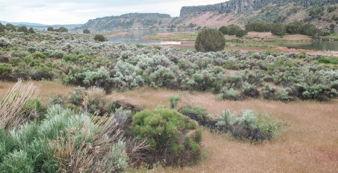
This stretch of the Snake River has miles of scenic walking paths near the water but also weaving in and out of lowland marsh and back up to the tops of rocky cliffs overlooking the river. For sweeping cliff views, head past the camping area on the gravel road until it ends at the start of a walking path. From there, continue on to the cliffs, but be careful as you approach the different viewing areas atop the cliffs; there’s nothing to stop you from falling 500 feet or more to the rocky shore below if you venture too close to the edge.

Geological Formations at Massacre Rocks
The cliffs on the South side of the river contain myriad layers of rock and sediment, layer after layer stratified and exposed to the hot Idaho sun. Pelicans fly through the canyon at eye level before touching down in the cold currents below. Steep cliffs and rocky canyons like this are common along the Snake River and further South in Idaho’s Owhyee Canyonlands near Jordan Valley, Oregon. You’ll find even more near the gold mining ghost town of Silver City, in the heart of the Owyhees. But the exposed layers here in Massacre Rocks show a unique geological history.


Basketball at Massacre Rocks State Park

Practice Your Jump Shot at Massacre Rocks
Few Idaho campgrounds also have basketball courts and hoops. So Massacre Rocks is unique in that, because it has several standard height basketball hoops between the two camping loops. The basketball hoops sit to one side of a large parking area, and there are no court markings. But the makeshift court overlooks the Snake River and canyon. Pelicans fly overhead while you dribble and shoot. The slight angle of the pavement makes it a little more difficult. But these basketball hoops are a great way to burn off some energy or get moving after a long drive.


DiscGolf at Massacre Rocks State Park
You might not think of dry, arid high desert landscape as a destination for DiscGolf. But Massacre Rocks has a full DiscGolf course that runs the length of the park, stretching along the Snake River. Watch for rattlesnakes near rocks as you hike through sagebrush. And the visitor center sells gear and accessories if you don’t have your own. Save the course map above and the score card below for your trip, courtesy of Idaho State Parks and Recreation.

Boating and Fishing at Massacre Rocks State Park

Snake River Boat and Fishing Access
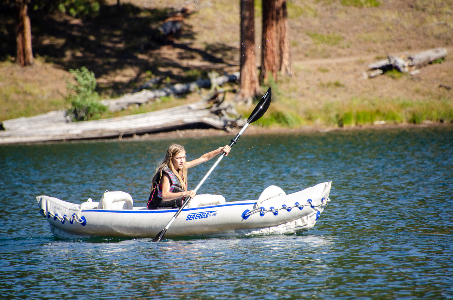
To access the Massacre Rocks State Park boat ramp, continue past the camping loops to the East. Travel down the dirt access road and then turn North (left) to approach the ramp and river access. From here, you can explore the river upstream toward American Falls. You can also head back downstream through the park. Across from the camp sites, you’ll find Beaver Island and Goat Island. Further downstream toward Register Rock, calm, marshy streams and protected coves offer a variety of fishing spots.


History at Idaho Campgrounds

Massacre Rocks Interpretive Center
To learn more about regional and natural history, the state park’s interpretive center is a great place to start. The center opens at 8 most summer days. But even when it’s closed, outside displays and self-guided signs provide lots of great natural history and historical information. Read about ancient volcanic activity and high desert flora and fauna, for example. And learn about the historical events surrounding the indigenous groups that pre-dated Westward expansion and the Oregon Trail that runs through the site.

The Po’hagwe Trail

Walk the Sagebrush Trail of the Shoshone
Starting at the interpretive center, follow the Po’ hogwe Trail down through sagebrush and boulder fields with views of distant peaks and the bend in the Snake River. The sign at the start of the trail notes that “Po ‘hogwe is a Shoshone word, which means ‘Sagebrush People’. The early people in this area utilized sagebrush for many things including a type of footwear resembling sandals and for building material to construct a ‘Wikiup’. A wikiup is a shelter made from hoops of willow with a thatched cover of grass and sagebrush.”

Explore Ancient Pathways Along the Snake River
“The Snake River corridor has been a travel route for thousands of years. Remnants of early human habitation date back thousands of years. . . . the Snake River corridor . . . provided an ample water supply, the river habitat provided abundant fish and game, and the terrain was level and easily traveled.”
– Massacre Rocks State Park Interpretive Sign
The Oregon Trail at Massacre Rocks State Park

The Oregon Trail: Wagon Ruts and the Route to California
“Jesse Applegate, captain of a contingent of several hundred emigrants, gives this account of a day on the trail in the year 1843:
– National Park Service, Department of the Interior
‘The day started at 4:00 a.m. The men gathered the cattle and horses. From 6:00 to 7:00 tents were taken down, wagons loaded, the team yoked and breakfast eaten. At 7:00 a.m. the wagons headed out. Most people walked along the trail throughout the day because it was easier than sustaining the constant jolting and bouncing of the springless wagons.’
‘At noon the teams were turned loose from the wagons. A short meal was eaten. Hooked up the teams and traveled until the sun was low in the western sky. Everyone helped gather firewood or buffalo chips for the evening fire. By 8 o’clock the evening meal was over. Music is heard throughout the camp. It has been a prosperous day; more than 20 miles covered.”

What Was it Like to Travel the Oregon Trail?
“Imagine standing on this spot in mid-summer of 1853. You would see many wagons pulled by teams of oxen trudging by in the hot afternoon sun. You are on the Oregon/California Trail: a 2000-mile-long trail which began in Missouri and ended in Oregon or California. The long journey took about 4-5 months to complete.
– National Park Service, Department of the Interior
At this point, you have traveled approximately 1300 miles. Thousands of emigrants passed this point between the years 1841 and 1865.
The thousands of wagons that passed this point carved the deep ruts that lie before you. Massacre Rocks State Park is one place that still has part of the original Oregon/California Trail left in good condition.”
The Oregon Trail at Register Rock
Where is Register Rock?
Register Rock sits just a few miles downstream from the state park. The rock sits beneath a protective roof structure and is completely enclosed by chain-link fence, but small window-like openings allow for a closer view of the etched inscriptions, made by settlers with axle grease and chisels. In the same park, other etchings are visible, including a child’s drawing that was later signed by the artist decades later when he returned to the area for a visit. The other etchings in the large white stones nearby date to the mid-20th Century, and unlike other road-side graffiti, mostly contain only names and dates.


What is Register Rock?
“After their meals were cooked and their livestock grazed, early pioneers took time to record their presence on this and other rocks in the area. The land around Register Rock was a common camping area along the Oregon and California trails. It has been preserved by the Idaho Department of Parks and Recreation so that the modern visitor may enjoy a landmark of the past.”
– Department of the Interior Interpretive Sign at Register Rock

Natural History at Massacre Rocks State Park

High Desert Sage and the Sagebrush Sea
“Of all the habitats in the West, the sagebrush high desert has fared the worst! The shrub-steppe is home to over 200 kinds of birds and 30 kinds of mammals.
– Idaho State Parks Interpretive Sign, “Sagebrush: Symbol of the West”
Big sagebrush is a highly nutritious and digestible food source containing four times the protein of other range vegetation in the winter for big game animals such as mule deer, elk, and antelope.
Over 90% of the ‘sagebrush sea’ that once covered much of the American West has been converted to cropland, grassland, or urban development.
Several wildlife species use sagebrush for critical food, nest, rest, escape. Some species, such as sage grouse, are wholly dependent on sagebrush habitat for survival.”

The American White Pelican – White Gliders
“The American White Pelican (Pelecanus erythrorhynchos) is a common sight in the skies over Massacre Rocks State Park from about mid March until mid October. This pelican seems ungainly when on land, but once in the air all appearances of clumsiness fall away as it soars over the Snake River on its large white wings. One of North America’s largest birds, the wingspan of these huge birds can approach nine and a half feet.”
– Idaho Fish & Game; Idaho State Parks Interpretive Sign, “White Gliders”
Nearby Attractions

Wind and Solar Power In Eastern Idaho
Wind Turbines on the Oregon Trail
This area has become a major source of wind power, and giant windmills tower over the wagon wheel ruts of the Oregon Trail as they follow the Snake River before heading up and over the surrounding hills. You can also view the turbines from the Oregon Trail path and wagon ruts, a hike that starts at the end of the gravel road past the State Park.

Economic Development and Sustainable Energy
Dozens of wind turbines spin along the Oregon Trail, the rotating blades slowly turning to face the wind. Thanks to the wind turbines, the landscape in this part of Idaho has changed dramatically over the last 10 years or so, which is really something in a region that has historically developed slowly and incrementally.

American Falls

Where is American Falls?
American Falls is only 15 minutes away from Massacre Rocks State Park. It has a reservoir, water sports, and waterfront parks below the old and new dams that provide even more power to the region and the rest of the state. In the center of town, you’ll find a large city park with a great playground and tons of grassy areas to picnic and play in the shade. Restaurants, a grocery store, and other shops line the surrounding streets. American Falls is a great place to re-fuel and re-stock when staying at Massacre Rocks State Park.

The Hydroelectric Dam at American Falls
American Falls is really the second version of the town post-dam. The U.S. Bureau of Reclamation built the original dam in 1923, and the town moved to higher ground in 1925. Renovations on the dam took place in 1927 and again in 1973, resulting in the 87 square mile American Falls Reservoir and 100 miles of shoreline. At the far end of the American Falls Reservoir, the original hydroelectric buildings and operations are visible alongside the more contemporary – and much larger – hydroelectric dam and falls.


Trenner Park and the American Falls Power Plant
“The original American Falls Power Plant was built in 1902 and acquired by Idaho Power in 1916. Trenner Park, built in 1933, is Idaho Power Company’s first public recreation area. The project area provides opportunities for camping, boating, fishing, hunting, sightseeing, and hiking. . . . The reservoir is the largest reservoir on the Snake River in Idaho when full.”
– Idaho Power Sign at the American Falls Hydroelectric Project

Why Idaho Campgrounds are the Best Campgrounds
Massacre Rocks State Park – The Best of Idaho
The high desert setting of Massacre Rocks State Park, the sparse vegetation and sagebrush landscape in this part of the state, and the physical location of the park near the river and the Oregon Trail make this a unique but enjoyable camping spot, whether you’re tent, trailer, or RV camping. If you’re just passing through or driving over for a day trip, be sure to check out the hiking paths that lead from the park to the cliffs and the Oregon Trail markers further down the trail. Even though this Idaho campground is a little further than some of our other favorites like Three Island Crossing and Bruno Sand Dunes State Park, we’ll be back next year for more hikes, a brisk swim, and the gorgeous canyon views.



That looks like quite interesting desert…so beautiful. It seems like you really had an amazing experience there.
When I first read massacre rocks, I was thinking, someone got massacred here? Haha. Crazy no? The place looks very nature ish which is not my vibe but I know people who would love t.
That’s an amazing place. Perfect landscape, perfect scenery.
It’s really quite beautiful, in a desert kind of way!! And there are so many different places and things to explore, too.
This is a beautiful post! I loved how your activities are so amazing for the kids.
The place looks fun and lovely too. You really had a great time, it seems.
It definitely seems worth it to me! What a beautiful place it is! I’d love to visit someday in the future.
I like camping especially with my family too. I like having my virtual camping while browsing through your post. Thanks for sharing.
how beautiful! The views are breathtaking! Thank you for sharing it. I miss the outdoors badly
You must have had so much fun the place looks beautiful and peaceful
Oh, wow! Snake River looks amazing! I used to go to school in central Washington and go out to eastern Washington a lot. That landscape out there is breathtaking.