Written by Mod Fam on September 1, 2020
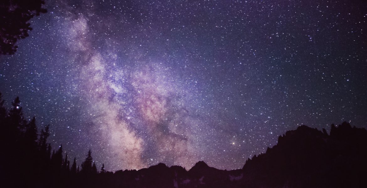
Explore the Best Baron Lakes Idaho Hikes
#PNW . Backpacking . Hiking . Idaho . Outdoor Recreation . Tent Camping . TravelExplore the best Baron Lakes Idaho hikes with our backpacking guide. Our favorite 25 mile route begins at the Grandjean Campground Trailhead before winding up along Baron Creek to the three Baron Lakes. Camp along a dramatic ridge or push through to the lakes for your first night. And enjoy unobstructed views of the stars from these 8,000 foot alpine lakes.
Written by Mod Fam on July 22, 2020
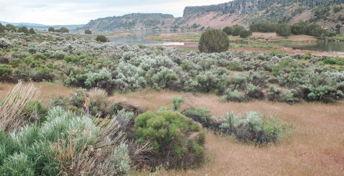
Idaho Campgrounds – Massacre Rocks State Park and the Oregon Trail
#PNW . Hiking . Idaho . Outdoor Recreation . Trailer Camping . Travel . United StatesWhile camping at Massacre Rocks State Park, hike along the Snake River canyon and sections of the Oregon and California Trails. Experience the rich history of the Po’hogwe Trail and learn about the Shoshone people who first inhabited this area of Idaho. Visit nearby attractions in American Falls and fish near the historic American Falls hydroelectric dam, now managed by Idaho Power.
Written by Mod Fam on July 15, 2020
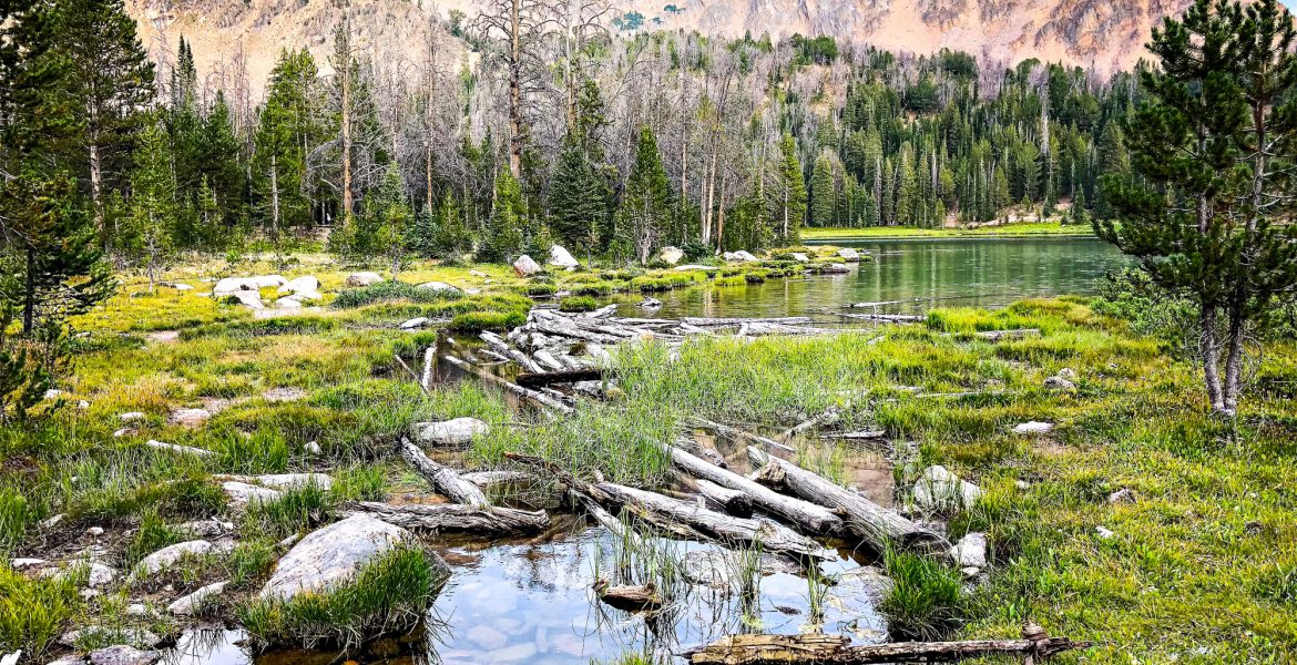
Hikes Near Stanley Idaho – Chamberlain Lakes and the White Clouds Wilderness
#PNW . Backpacking . Hiking . Idaho . Outdoor Recreation . Tent Camping . TravelFor the best hikes near Stanley Idaho, check out the White Cloud Wilderness and the Chamberlain Lakes. Starting with an easy hike to Fourth of July and Washington Lakes, the increasingly difficult loop takes you high into alpine country below Castle Peak.
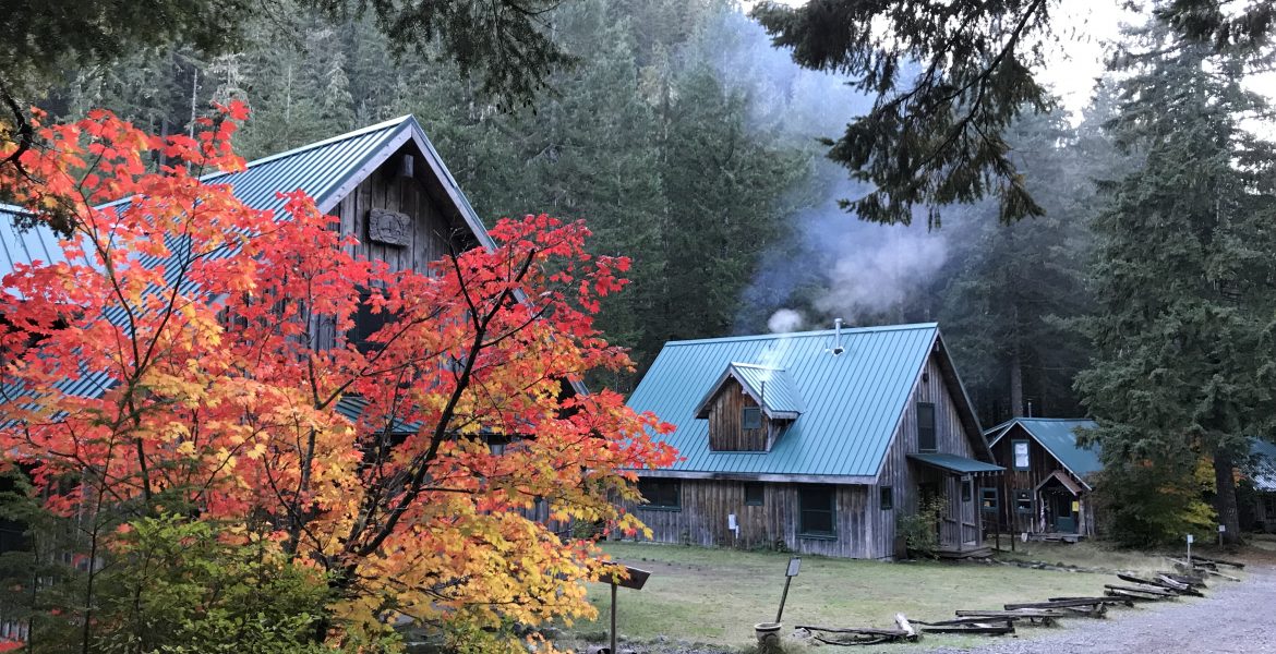
Written by Mod Fam on July 3, 2020
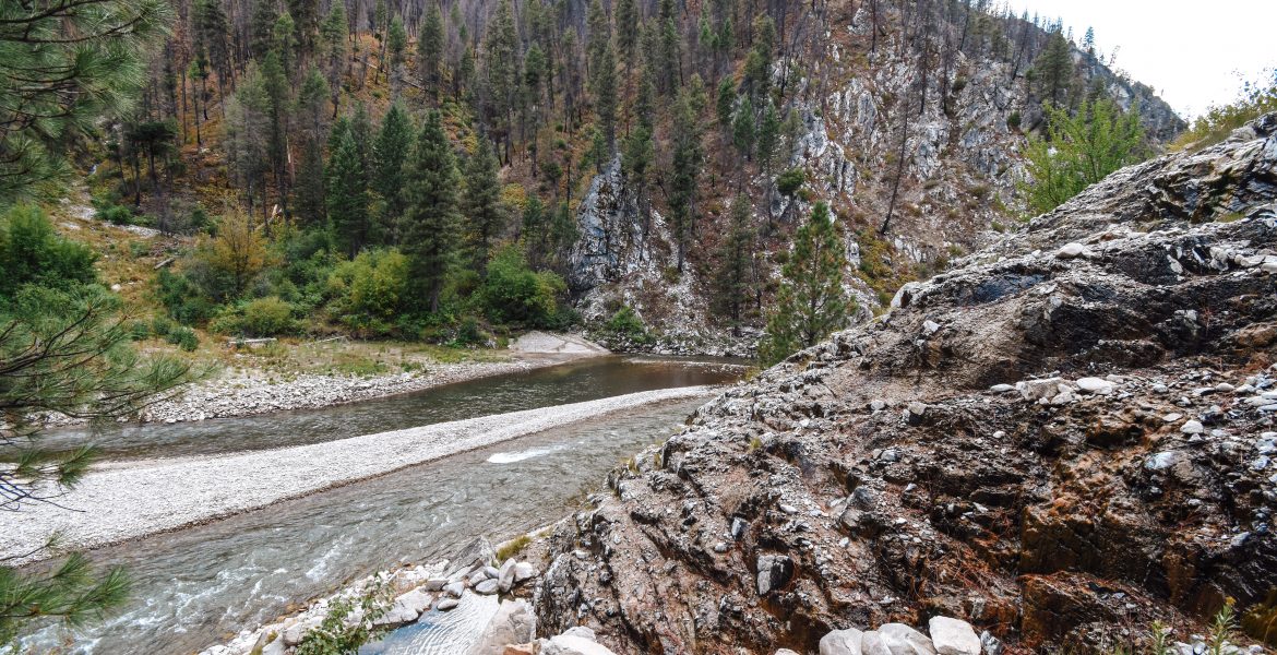
Hot Springs Near Boise Idaho – The Best Natural Hot Tub Waterfall
#PNW . Idaho . Travel . United StatesPine Flats Hot Springs is a great mix of accessible and remote, undeveloped but comfortable. The short hike keeps the crowds down, but the trail is maintained and easy to moderate, depending on weather conditions.
Written by Mod Fam on June 15, 2020
Oregon Hikes – Opal Creek Hike
#PNW . Hiking . Oregon . Outdoor Recreation . Travel . United StatesVisit Opal Creek, Oregon and the Ancient Forest Center, a private, non-profit educational center in Oregon’s Opal Creek Wilderness. The historic settlement sits along Opal Creek near a Depression-era water wheel and power station in the wilderness area.
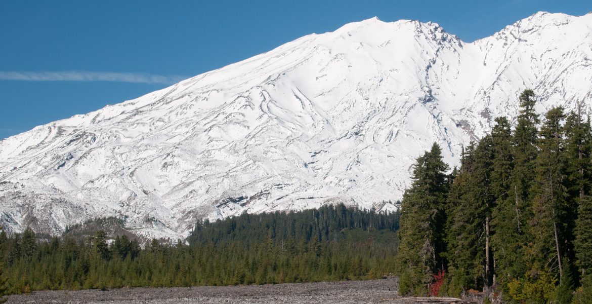
Written by Mod Fam on May 15, 2020
Gifford Pinchot National Forest Hikes – Lava Canyon Trail #184
#PNW . Hiking . Outdoor Recreation . Travel . United States . WashingtonDiscover the Best Gifford Pinchot National Forest Hikes Near Mt. St. Helens. Hike the 2-mile Lava Canyon Trail to see lava formations, waterfalls, & more! Lava Canyon Trail #184 has both an accessible, paved hiking path and a moderate to difficult section of trail that follows the Muddy River down to the base of the canyon.
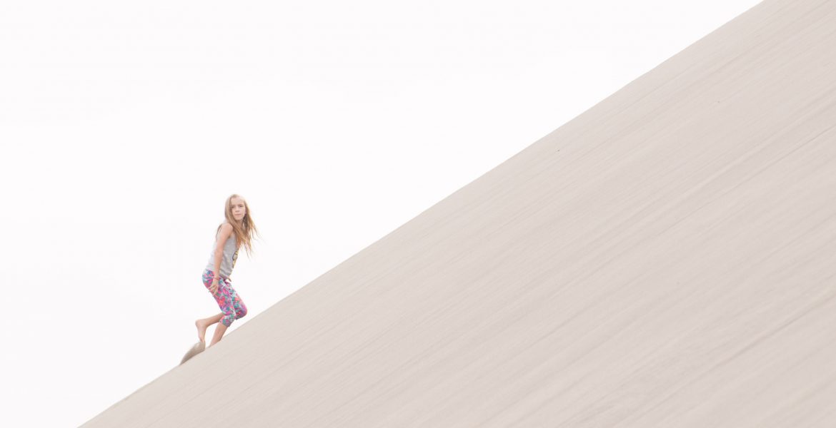
Written by Mod Fam on May 1, 2020
Camping in Idaho – Bruneau Sand Dunes
#PNW . Hiking . Idaho . Outdoor Recreation . Trailer Camping . Travel . United StatesOne of the state parks along the Snake River basin is Bruneau Sand Dunes, the surprising location of North America’s tallest free-standing sand dunes, kept in place by near-constant opposing winds. The Dunes state park also has an interpretive center observatory and day-use area if you’re not planning to stay overnight.
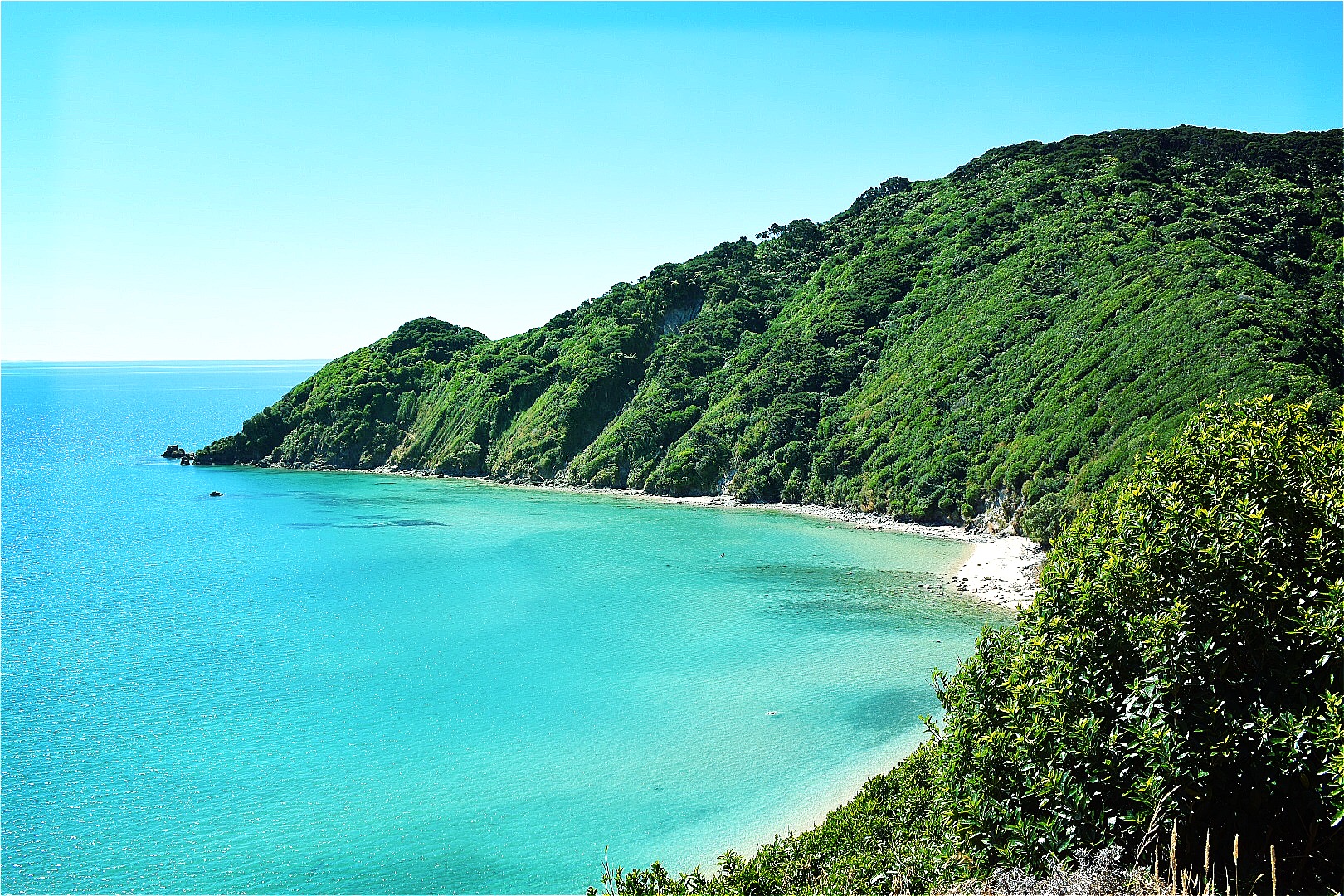
Written by Mod Fam on June 1, 2019
Abel Tasman Coast Track – Great Walks NZ
Backpacking . Hiking . New Zealand . Outdoor Recreation . Tent Camping . Travel . Worldwide TravelIf you’re thinking of either a long day hike or a longer, overnight trek, add Abel Tasman National Park to your list of stops on your two week trip. We’ve hiked the Milford Track, one of New Zealand’s Great Walks, and many shorter treks throughout the South Island. The scenic views, secluded beaches, and dense native bush of Abel Tasman make this one of our favorite areas to hike and camp (and we have a lot of favorites in New Zealand!).
Written by Mod Fam on May 28, 2019
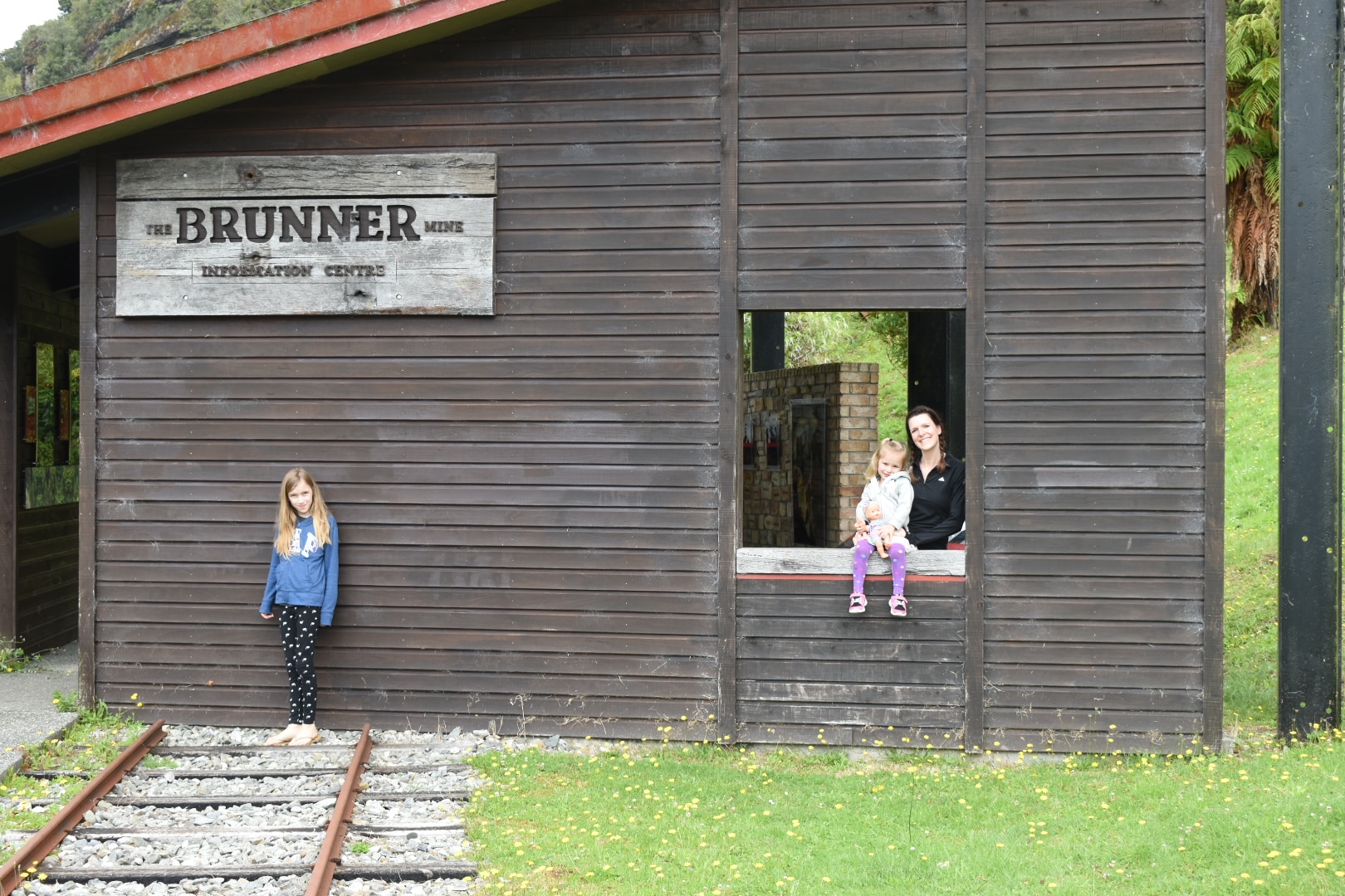
New Zealand Itinerary – Brunner, Waiuta, and Motueka
Hiking . New Zealand . Outdoor Recreation . Travel . Worldwide TravelWe planned day four as a driving day to cover about 1/3 of the length of the South Island, from Hokitika all the way to Motueka, on the South Island’s North Shore between the Abel Tasman National Park and the wine-growing region of Nelson, Picton, and Blenheim. If you have a little more time, you could easily break this into two segments and stay in Reefton, the first town in New Zealand and all of the Southern Hemisphere to receive electricity. You can easily cover the distance with a few fun stops in less than a full day.
Written by Mod Fam on May 24, 2019
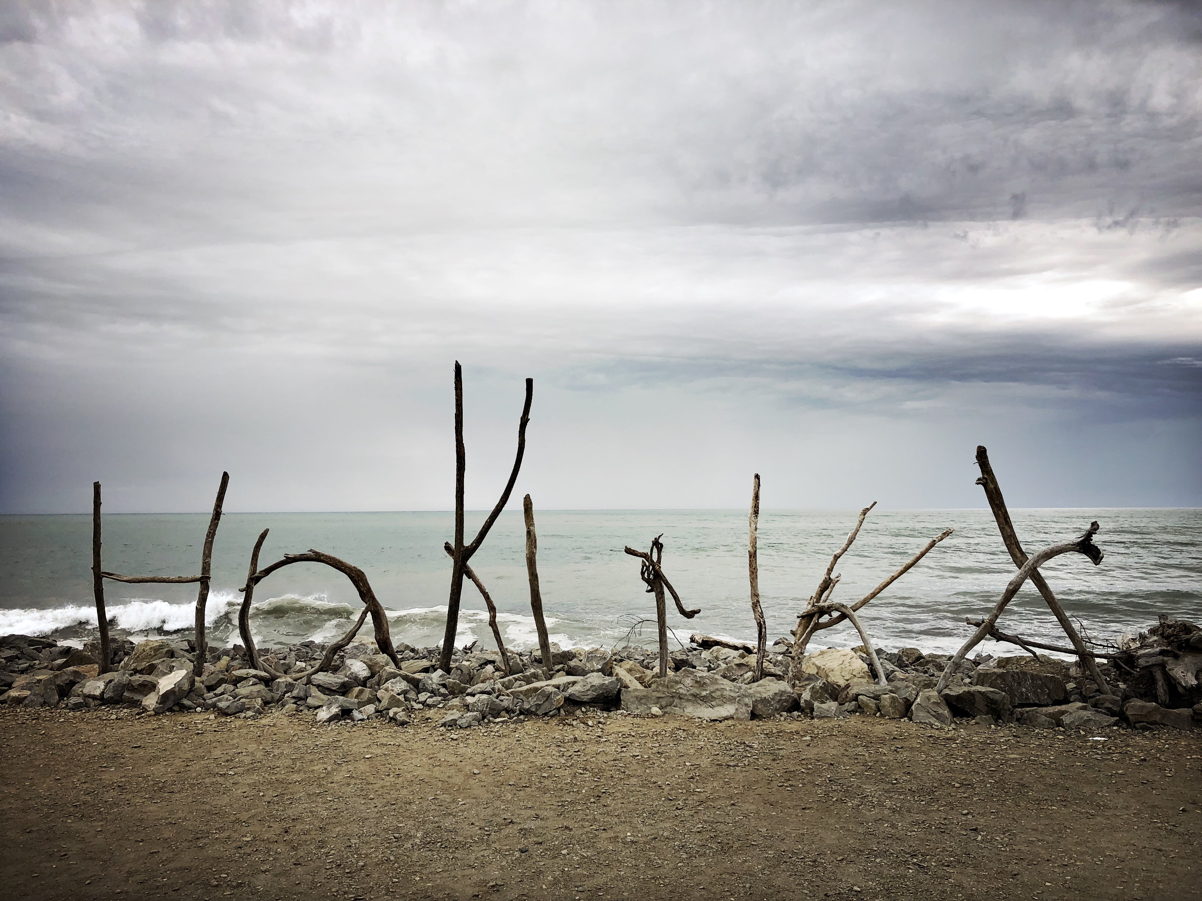
New Zealand South Island Road Trip – Hokitika
New Zealand . Outdoor Recreation . Tent Camping . Travel . Worldwide TravelHokitika is known for its greenstone shops and other tourist attractions. Originally a gold mining town in the 1860s, Hokitika was once one of the most populous New Zealand cities. Even though the original industries have faded, it has become a popular tourist destination along the West Coast, and we recommend spending at least half a day checking out the historical downtown area and gray sand beaches.