Gifford Pinchot National Forest Hikes Near Mt. St. Helens
Lava Canyon Trail #184: Easy to Moderate
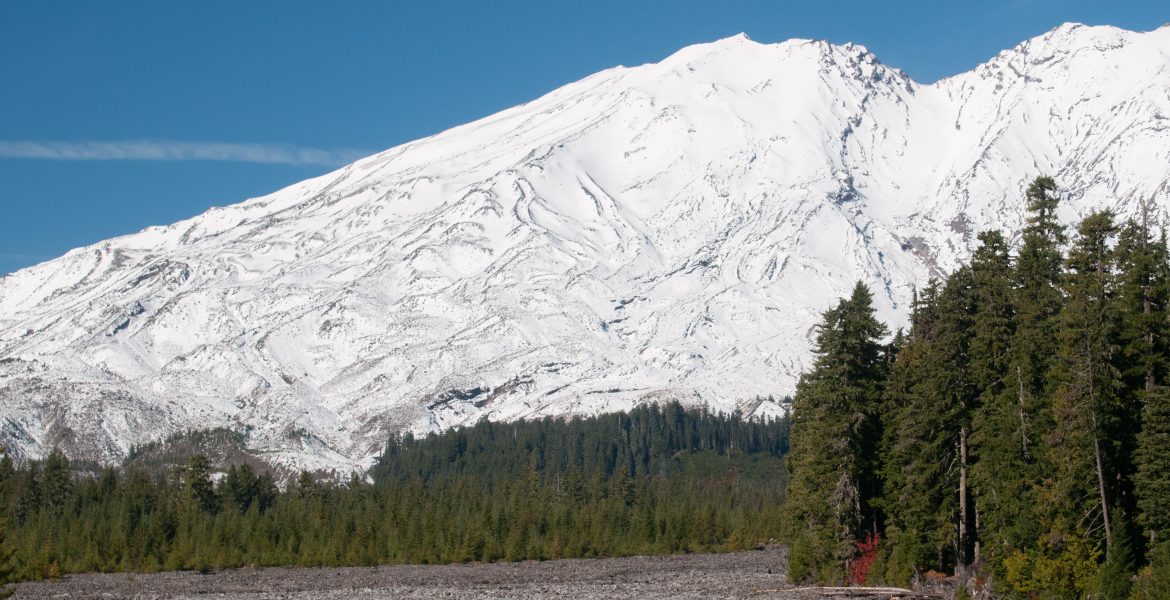
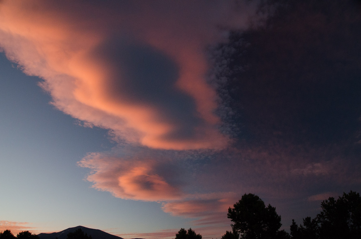
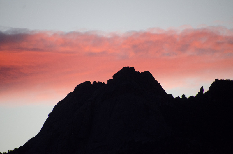
Gifford Pinchot National Forest Hikes Mt. St. Helens may be one of the most recognizable mountains in the Pacific Northwest and Washington State, owing to its dramatic eruption in 1980 and the subsequent changes to the surrounding landscape from a combination of molten lava and ash. On the South side of the mountain, the eruption caused a different kind of change in scenery, though. Unlike the carved lava beds to the North and the plumes of ash for hundreds of miles around, the South side experienced a different kind of change to the ecosystem. This is because the heat from the eruption melted ice and snow, which mixed with rock, soil, and other debris to create a flood that scraped and carved the valley below, right through Lava Canyon.
Today, the Lava Canyon Trail #184 has both an accessible, paved hiking path and a moderate to difficult section of trail that follows the Muddy River down to the base of the canyon. Keep reading below for directions to the Lava Canyon Trail and our recommendations for one of the most interesting day hikes in the Gifford Pinchot National Forest near Mt. St. Helens.
Mt. St. Helens seen from the South at Muddy Creek and the Lava Canyon trail
Gifford Pinchot National Forest Hikes Information
Distance to Trailhead
Distance from Vancouver, WA. to the Lava Canyon Trailhead: 67 miles (108 km)
Vancouver to Woodland, Ariel, Yale, and Cougar via I-5 and State Highway 503: 55.3 miles (89 km)
Forest Road 83 to Trailhead: 11.3 miles (18.19 km)
Distance from Cascade Locks, OR. to the Lava Canyon Trailhead: 67 miles (108 km)
Cascade Locks to Carson, Stabler, Northwoods, and Forest Road 83: 56 miles (90.12 km) – Toll bridge
Forest Road 83 to Trailhead: 11.3 miles (18.19 km)
Elevation & Difficulty
Elevation: 1,600 to 2,800 feet
Hiking distance of unpaved Lava Canyon Trail: 1.8 miles (2.9 km)
Hiking difficulty: Moderate to difficult, with some steep, slippery/wet sections of trail and a 30-foot vertical ladder connecting upper and lower sections of the trail
Warnings: Stay on the marked paths near the waterfalls; fatalities have occurred in this area because of leaving the trail and slipping around the upper falls.
Fees & Amenities
Day-use fee: $5
Amenities: Federal Forest Service restrooms at trailhead; 1 mile (1.6 km) of paved and accessible pathways descending from parking and trailhead to upper falls
Contact & Updates
Closures and Updates: Check the U.S. Forest Service Lava Canyon Trail #184 website for closures and updates; the suspension bridge is undergoing repairs due to damaged cables, and COVID-19 closures of forest service road 83 are currently in effect
Contact: Call the Mount St. Helens National Volcanic Monument Administrative Headquarters at (360) 449-7800
Planning a trip soon? Click either of our banner links here to get discounted gear and car rentals to get you out into the Gifford Pinchot National Forest. Our site is partly supported by affiliate partnerships; your purchases through our affiliate links help support our site and the development of even more great content!
Washington State Highway 14 E just West of Northwoods, WA
Gifford Pinchot National Forest Hikes: Getting to Lava Canyon Trail #184
The two maps below provide the two main routes from the South. One will take you from the Portland/Vancouver area. The other starts further East along the Columbia from The Dalles or Hood River, crossing at the Bridge of the Gods and continuing North. Northern routes that leave I-5 at Castle Rock or around Mount St. Helens from the North also connect to the Lava Canyon Trailhead. Both of our routes are almost exactly 67 miles, though the Washington State Highway 14 route is more scenic and rural. The fastest route from Portland and Vancouver speeds North along I-5 before turning back East. Along I-5, you can head Northeast at Battle Ground or continue as far as Woodland before following WA-503 to Yale and Cougar and then onto Forest Service Road 83 and the trailhead.
Mount Hood, seen from the Portland, Oregon areaThe Bridge of the Gods, a toll bridge connecting Washington and Oregon over the Columbia River
The Scenic Route – Cascade Locks North
The route North along I-5 may be faster, but the road from Cascade Locks and the Bridge of the Gods has much more scenic views to enjoy. The road winds through small, rural towns before climbing higher elevations into the national forest surrounding Mount St. Helens. If you have a little extra time, it’s worth taking this route, even if you’re starting in Portland, Vancouver, or further South toward Salem or Bend.
The forest service roads leading to Gifford Pinchot National Forest Hikes all around Mount St. Helens provide sweeping views of the various valleys surrounding the volcano. To the North, the forests have regrown in the 40 years since the eruption. To the South, the carved landslide and fields of debris are still visible from the mountain down to Lava Canyon and the Muddy River.
Parking, Accessibility, & Access
Once you arrive at the Lava Canyon Trailhead parking lot, you’ll find ample parking and serviced vault restrooms, similar to other federal forest service amenities. After a series of interpretive signs and information about the area, the paved path descends and winds back and forth for about 1/2 mile, ending at raised viewing platforms near the upper falls. Another, non-accessible loop with stairs and raised walkways loops down to a wooden suspension bridge that circles back around to the paved paths above or the unpaved hiking trail leading down into the canyon.
The Gifford Pinchot National Forest, North of Mt. St. Helens in Washington State
“DANGER!! Several fatalities have occurred in and around these waters. STAY ON THE TRAIL” – Warning sign near the upper falls near the Lava Canyon Trailhead at Forest Service Trail 148
Carved lava rock at the top of the falls on the Lava Canyon trail
The smooth volcanic rock carved by the Muddy River is much more exposed today as a result of the 1980 eruption. The flood of debris re-carved the canyon down to the volcanic rock, removing centuries of organic buildup that had grown up and filled the canyon. Interpretive signs along the accessible route describe the formation of the canyon and the more recent geological history of the area. The cool, wet microclimate makes the polished volcanic rock especially slippery. This is why the forest service has posted warning signs. It’s also why several people have slipped and fallen near the upper falls.
Water rushes through narrow, rocky canyons at the Lava Canyon Trail
Photography Tip: What Lenses to Carry
The best way to get closer to the falls is to bring a telephoto lens with you on the hike. For a day hike like this one, I prefer my 70-300mm Nikkor lens for my D-SLR bodies. This is because it gives me the best range and flexibility for close-up photos of the falls. It also gives me slightly wider angles without the weight of a larger lens. I also carry a wide-angle lens for shots of the full canyon and epic views of Mount St. Helens.
The best way to get closer to the falls is to bring a telephoto lens with you on the hike. For a day hike like this one, I prefer my 70-300mm Nikkor lens for my D-SLR bodies. This is because it gives me the best range and flexibility for close-up photos of the falls. It also gives me slightly wider angles without the weight of a larger lens. I also carry a wide-angle lens for shots of the full canyon and epic views of Mount St. Helens.
The Lava Canyon Trail Suspension Bridge
Continue past the accessible path to the second half-mile loop, and you’ll come across this wooden plank suspension bridge that stretches 125 feet across the canyon and a series of waterfalls below. The bridge has considerable sway and movement, typical of a cabled suspension bridge. Though perhaps not for the faint of heart, the suspension bridge is much less frightening than the 30-foot metal rung ladder on the hiking trail below.
A long suspension bridge below the upper falls leads to the more difficult sections of the Lava Canyon TrailWalking across the suspension bridge along the Lava Canyon Trail
Just beyond the suspension bridge, the pathway forks, leading back up to the trailhead or further down the canyon on the Lava Canyon Trail. Until now, the difficulty of the loops has been very easy. But if you continue along the unpaved hiking trail, it becomes moderately difficult in parts. The views are worth the effort, though, as you descend another 1,000 feet or so to the end of the trail. Here, it intersects Smith Creek Trail 225. A lower trailhead at the Smith Creek Trail allow for a different starting point. Or, if you prefer not to huff it back up the canyon, you can also plan a one-way hike down. We saw hikers starting up from the lower trailhead, so they could end on a downhill hike, too.
Elevation change from the Lava Canyon Trailhead to the base of the trail and backMore waterfalls below the suspension bridge along the Lava Canyon Trail
The Lava Canyon Trail – Moderate to Difficult Sections
Immediately to the North of the suspension bridge, the Lava Canyon Trail diverges from the easier loops and follows the canyon East. The first section may be one of the most difficult, because it skirts high cliffs along a rocky ledge. This section of trail crosses a steep rock face with a cable grab-line and then crosses the water before heading downhill with a series of switchbacks.
A rebar and steel ladder connects sections of the Lava Canyon Trail over a steep ledge
After winding through a variety of open, forested areas, the trail reaches a 30-foot steel and rebar ladder that drops over the side of a cliff to connect the upper and lower trail sections. And the cool, damp ecosystem in the canyon ensures that the rungs are moist and somewhat slippery. So take your time and don’t rush this part! If you are concerned about heights or traversing the ladder, we recommend starting at the lower trailhead and working your way up the canyon instead of finding yourself first at the top of the ladder looking over the precipice.
Ship Trail 184B – Views Atop a Lava Formation
A side trail leads to a hilltop in the center of Lava Canyon
Just above the ladder traverse, the main Lava Canyon Trail intersects with Ship Trail 184B, a short, 0.2 mile path to the top of a central rock structure overlooking the canyon and a series of waterfalls. The trail is not marked and can be difficult to spot, so take your time until you see the path leading up the side of the lava formation. The view is well worth the effort, and the scenic trail winds through rugged lava formations, mossy undergrowth, and towering deciduous and evergreen trees.
Enjoying the view atop a lava formation in the center of Lava CanyonLooking down from the center of Lava Canyon
This is where my 70-300mm lens really pays off! Standing about 100 feet above the canyon floor atop “the Ship,” I’m able to capture waterfalls and foliage and the varied textures of the lava formations up and down the canyon. Don’t miss the short climb up to the Ship, because these are some of my favorite views of the entire hike. This is also a great spot to sit and relax in the afternoon sun, enjoy a snack, and refresh before the hike back out of the canyon.
This is where my 70-300mm lens really pays off! Standing about 100 feet above the canyon floor atop “the Ship,” I’m able to capture waterfalls and foliage and the varied textures of the lava formations up and down the canyon. Don’t miss the short climb up to the Ship, because these are some of my favorite views of the entire hike. This is also a great spot to sit and relax in the afternoon sun, enjoy a snack, and refresh before the hike back out of the canyon.
Waterfalls cascade the length of Lava Canyon, framed by lush, green foliage and hard volcanic rockRock walls in the center of Lava CanyonThe bottom of Lava Canyon at Smith Creek Trail 225
Below the 30-foot ladder, the trail begins to widen and flatten as the Muddy River approaches the Smith Creek Valley. The trail intersects Smith Creek Trail 225, so you can continue hiking along the valley floor beyond the dramatic canyon. The trail leads to a wide alluvial fan as the canyon walls descend into the more gently rolling hills below. Though different than the steep, dramatic canyon walls of etched lava formations, the Smith Creek Valley is no less impressive. The vast scale of the hills and mountains surrounding the carved valley floor create a different sense of wonder. Evidence of various mammals is abundant. From claw marks in birch trees to human etchings on the landscape, signs evoke hikes from long ago. And there’s even an homage to Sasquatch, famous in these parts.
Evidence of large animals in Lava CanyonEvidence of other, less ferocious animals in Lava Canyon
Gifford Pinchot National Forest Hikes: Gary Rosenquist’s photos of the 1980 eruption
Driving North to the Mt. St. Helens Lookout
After your Gifford Pinchot National Forest hikes, it’s worth driving around the valleys further North that skirt Mount St. Helens. Forest Service Road 25 (closed during the winter) circles around to the North. It passes Spirit Lake to lookouts with sweeping views of the valley and Mt. St. Helens. Famously, on May 17, 1980, Gary Rosenquist and his friends camped here, about 11 miles Northeast of Mt. St. Helens, when he captured the eruption in a series of 22 photographs from his campsite. Interpretive signs share the most dramatic shots, comparing the views Rosenquist captured with the view of the volcano today.
The Gifford Pinchot National Forest, North of Mt. St. Helens in Washington StateThe North side of Mt. St. HelensThe North side of Mt. St. Helens
Rosenquist’s Photos of the Eruption
National Forest Interpretive Sign with photos of the 1980 blast, taken by Gary Rosenquist
“Gary Rosenquist wanted eruption pictures. On May 17, 1980, he and friends Joel and Linda Harvey, their 10-year-old son Jo-Jo, and William Dilley drove down from Tacoma. They camped here at Bear Meadow, 11 miles northeast of Mount St. Helens. The next morning, the group witnessed the colossal landslide and unprecedented lateral blast, and nearly lost their lives. Rosenquist managed to capture 22 photographs of the eruption before fleeing to safety. His pictures help us understand the dynamics of this astonishing event. Gary Rosenquist wanted pictures. He got more than he bargained for…
– “More Than He Bargained For” Interpretive Sign, Mount St. Helens National Historic Monument. Gifford Pinchot National Forest and the U.S. Department of Agriculture
Love a good national park find and travelling to find good hiking spots! This is really inspiring us to get out and explore
Marcea
5 years ago
What a beautiful place! I would have to look from the bottom without hiking on my own but would so enjoy the view.
Giulia
5 years ago
These landscapes are stunning. I would love to walk on the The Lava Canyon Trail Suspension Bridge, though I’m slightly afraid of heights.
rosemary | a hint of rosemary
5 years ago
I doubt that I could manage all of that hiking but I would love to visit that area. Your photos are amazing. I enjoyed scrolling through the pictures imagining what it would be like to be there.
Thanks Rosemary! It’s a beautiful area, and it’s fun for us to be able to capture it on “film” (or at least the digital equivalent!)
Ashley
5 years ago
I think my favorite is the tall trees and the winding road. Beautiful!
Tracy @ Cleland Clan
5 years ago
Wow! What a gorgeous hike! The scenery is spectacular. Crossing the suspension bridge and climbing the ladder just add to the adventure.
Ina
5 years ago
Amazing place. Thanks for sharing this with us!
Belle
5 years ago
Thank you for those are fantastic photos! though i can’t be in the lava canyon, seeing your post made me remember that i was suppose to start hiking last march but due to the pandemic i wasn’t able to attend beginners hikes.
Belle
5 years ago
Those are fantastic photos! Though I can’t be in lava canyon, seeing your post made me remember that I was supposed to start hiking last march but due to the pandemic I wasn’t able to attend beginners hikes.
Charlotte Jessop
5 years ago
This looks stunning! I wanted to go here at the end of last year but our plans changed and now I’m sad because I don’t know when we will be allowed over again.


Love a good national park find and travelling to find good hiking spots! This is really inspiring us to get out and explore
What a beautiful place! I would have to look from the bottom without hiking on my own but would so enjoy the view.
These landscapes are stunning. I would love to walk on the The Lava Canyon Trail Suspension Bridge, though I’m slightly afraid of heights.
I doubt that I could manage all of that hiking but I would love to visit that area. Your photos are amazing. I enjoyed scrolling through the pictures imagining what it would be like to be there.
Thanks Rosemary! It’s a beautiful area, and it’s fun for us to be able to capture it on “film” (or at least the digital equivalent!)
I think my favorite is the tall trees and the winding road. Beautiful!
Wow! What a gorgeous hike! The scenery is spectacular. Crossing the suspension bridge and climbing the ladder just add to the adventure.
Amazing place. Thanks for sharing this with us!
Thank you for those are fantastic photos! though i can’t be in the lava canyon, seeing your post made me remember that i was suppose to start hiking last march but due to the pandemic i wasn’t able to attend beginners hikes.
Those are fantastic photos! Though I can’t be in lava canyon, seeing your post made me remember that I was supposed to start hiking last march but due to the pandemic I wasn’t able to attend beginners hikes.
This looks stunning! I wanted to go here at the end of last year but our plans changed and now I’m sad because I don’t know when we will be allowed over again.